
1973 Map of Barro
USGS Topo · Published 1977About this map
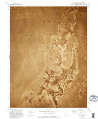
Barro serves as the primary focal point of this 1972 orthophotomosaic, situated along a lonely stretch of the Western Pacific railroad. This small outpost is defined by its isolation within a sprawling Mud Flat, where the landscape is marked by the distinct patterns of salt crust and sediment. The northern edge of the Wendover Air Force Range occupies the southern portion of the quadrangle, illustrating the intersection of military airspace with the Great Salt Lake Desert's floor. Infrastructure in this corridor is limited to a few vital links, including Interstate 80 and several Radio Towers, which provide essential communication and transit across the barren expanse. This survey captures a specific moment in the mid-1970s before modern navigational and telecommunication shifts altered the utility of these remote desert waystations.
Find a feature on this map
11 named features on this map. Tap any name to fly to it.
Don’t see what you’re looking for? This feature index may not catch every label — zoom into the map to look around manually.
Map Details
Editions of this 1973 Barro Map
This is the sole edition of this map. No revisions or reprints were ever made.
Other maps of this area

1953 · Tooele
USGS Topo · 1:250,000

1955 · Tooele
USGS Topo · 1:250,000

1973 · Knolls SW
USGS Topo · 1:24,000

1973 · Arinosa SE
USGS Topo · 1:24,000

1973 · Arinosa NE
USGS Topo · 1:24,000

1973 · Floating Island SE
USGS Topo · 1:24,000

1973 · Knolls
USGS Topo · 1:24,000

1973 · Knolls SE
USGS Topo · 1:24,000

1973 · Knolls 2 SW
USGS Topo · 1:24,000
1973 · North of Knolls
USGS Topo · 1:24,000