
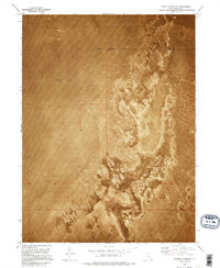
1973 Map of Knolls
USGS Topo · Published 1977About this map
Knolls serves as the primary landmark in this desolate section of the Great Salt Lake Desert, captured during a 1972 orthophotomosaic survey. The landscape is defined by the stark transition between expansive Mud Flat areas and rolling Sand Dunes, punctuated only by the industrial and military presence that characterized the region in the early 1970s. The Western Pacific railroad line and Highway 80 cut a straight east-west path across the northern terrain, providing a critical transportation link through an otherwise inhospitable environment.
Find a feature on this map
17 named features on this map. Tap any name to fly to it.
Don’t see what you’re looking for? This feature index may not catch every label — zoom into the map to look around manually.
Map Details
Editions of this 1973 Knolls Map
This is the sole edition of this map. No revisions or reprints were ever made.
Other maps of this area

1953 · Tooele
USGS Topo · 1:250,000

1955 · Tooele
USGS Topo · 1:250,000

1973 · Knolls SW
USGS Topo · 1:24,000

1973 · Aragonite NW
USGS Topo · 1:24,000

1973 · Barro
USGS Topo · 1:24,000

1973 · Knolls SE
USGS Topo · 1:24,000

1973 · Grayback Hills
USGS Topo · 1:24,000

1973 · Aragonite SW
USGS Topo · 1:24,000

1973 · Knolls 2 SW
USGS Topo · 1:24,000
1973 · North of Knolls
USGS Topo · 1:24,000