
1973 Map of Grayback Hills
USGS Topo · Published 1977About this map
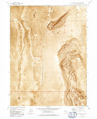
Hill Air Force Range dominates the northern and central landscape of this 1973 survey, a stark reminder of military land use in the Utah desert during the Cold War era. The terrain is characterized by the high, ridged forms of the Grayback Hills, which stand in sharp contrast to the surrounding lowlands. To the west lies the expansive and featureless Mud Flat, while the eastern portion of the sheet is occupied by the wide expanse of Ripple Valley. Human activity is primarily industrial and governmental, marked by the presence of Gravel Pits at the foot of the hills. The map also delineates a critical surveying boundary, showing the Base Line that serves as a foundational reference for land divisions in the region. The orthophotomap style of this edition provides a literal photographic ground view of the desert floor and its sparse vegetation patterns.
Find a feature on this map
9 named features on this map. Tap any name to fly to it.
Don’t see what you’re looking for? This feature index may not catch every label — zoom into the map to look around manually.
Map Details
Editions of this 1973 Grayback Hills Map
2 editions found
Other maps of this area

1953 · Tooele
USGS Topo · 1:250,000

1955 · Tooele
USGS Topo · 1:250,000

1973 · Ripple Valley
USGS Topo · 1:24,000

1973 · Grassy Mountains
USGS Topo · 1:24,000

1973 · Knolls 2 NE
USGS Topo · 1:24,000

1973 · Knolls
USGS Topo · 1:24,000

1973 · Aragonite NW
USGS Topo · 1:24,000

1973 · Finger Ridge
USGS Topo · 1:24,000
1973 · Aragonite
USGS Topo · 1:24,000
1973 · North of Knolls
USGS Topo · 1:24,000