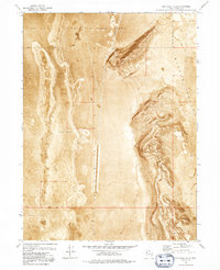
1973 Map of Grayback Hills
USGS Topo · Published 1992About this map
Hill Air Force Range dominates the northern expanse of this 1973 orthophotomap, where military restricted zones overlap with the arid terrain of the Great Salt Lake Desert. This specialized quadrangle uses an orthophoto base to reveal the stark geological transitions between the expansive Mud Flat to the west and the prominent elevations of the Grayback Hills. The imagery provides a clear look at the industrial and infrastructural marks on this isolated landscape, such as the Gravel Pits tucked near the ridges and the clear east-west demarcation of the Base Line. To the east, the map tracks the subtle topography of Ripple Valley, offering a precise record of desert geomorphology and military land use during the early 1970s.
Find a feature on this map
9 named features on this map. Tap any name to fly to it.
Don’t see what you’re looking for? This feature index may not catch every label — zoom into the map to look around manually.
Map Details
Editions of this 1973 Grayback Hills Map
2 editions found
Other maps of this area

1953 · Tooele
USGS Topo · 1:250,000

1955 · Tooele
USGS Topo · 1:250,000

1973 · Ripple Valley
USGS Topo · 1:24,000

1973 · Grassy Mountains
USGS Topo · 1:24,000

1973 · Knolls 2 NE
USGS Topo · 1:24,000

1973 · Knolls
USGS Topo · 1:24,000

1973 · Aragonite NW
USGS Topo · 1:24,000

1973 · Grayback Hills
USGS Topo · 1:24,000

1973 · Finger Ridge
USGS Topo · 1:24,000
1973 · Aragonite
USGS Topo · 1:24,000