
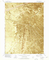
1973 Map of Aragonite NW
USGS Topo · Published 1977About this map
Mud Flat terrain and shifting Sand Dunes dominate this Great Salt Lake Desert landscape, providing a stark environment where transport corridors are the primary markers of human presence. The Western Pacific railroad and Interstate 80 cut a straight path across the desert floor, connecting the small siding at Clive and the vicinity of Deserta. This 1970s orthophotomap utilizes aerial imagery to reveal the precise textures of the salt crust and desert floor, illustrating the isolation of these remote transit points. The southern boundary of the map transitions into the Wendover Air Force Range, while the Grayback Hills rise to the northeast, offering the only significant topographic relief in an area defined by its extreme flatness and expansive alkali wastes.
Find a feature on this map
9 named features on this map. Tap any name to fly to it.
Don’t see what you’re looking for? This feature index may not catch every label — zoom into the map to look around manually.
Map Details
Editions of this 1973 Aragonite NW Map
This is the sole edition of this map. No revisions or reprints were ever made.
Other maps of this area

1953 · Tooele
USGS Topo · 1:250,000

1955 · Tooele
USGS Topo · 1:250,000

1973 · Ripple Valley
USGS Topo · 1:24,000

1973 · Knolls
USGS Topo · 1:24,000

1973 · Knolls SE
USGS Topo · 1:24,000

1973 · Grayback Hills
USGS Topo · 1:24,000

1973 · Aragonite SE
USGS Topo · 1:24,000

1973 · Aragonite SW
USGS Topo · 1:24,000
1973 · Aragonite
USGS Topo · 1:24,000
1973 · North of Knolls
USGS Topo · 1:24,000