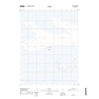
2023 Map of Knolls SW
USGS Topo · Published 2023About this map
The Great Salt Lake Desert dominates this section of western Utah, presenting a landscape of extreme salt flats and sparse relief. The vast expanse is defined by its role as part of the Utah Test and Training Range, a restricted military area that underscores the isolation and strategic utility of this environment in the twenty-first century. Minimal topographic variations across the desert floor are captured with ten-foot contour intervals, revealing the subtle mounds and depressions that characterize this arid basin. This document provides a clear record of military land management and the enduring physical geography of Tooele County's salt flats, where few man-made landmarks exist outside of the administrative boundaries of the training range.
Find a feature on this map
2 named features on this map. Tap any name to fly to it.
Don’t see what you’re looking for? This feature index may not catch every label — zoom into the map to look around manually.
Map Details
Editions of this 2023 Knolls SW Map
This is the sole edition of this map. No revisions or reprints were ever made.
Other maps of this area

1953 · Tooele
USGS Topo · 1:250,000

1954 · Wildcat Mtn
USGS Topo · 1:24,000

1955 · Tooele
USGS Topo · 1:250,000

1973 · Knolls SW
USGS Topo · 1:24,000

1973 · Arinosa SE
USGS Topo · 1:24,000

1973 · Arinosa NE
USGS Topo · 1:24,000

1973 · Wildcat Mountain NW
USGS Topo · 1:24,000

1973 · Knolls
USGS Topo · 1:24,000

1973 · Barro
USGS Topo · 1:24,000

1973 · Knolls SE
USGS Topo · 1:24,000