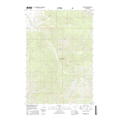
2017 Map of Knowles Peak
USGS Topo · Published 2017About this map
Knowles Peak and the surrounding high country of the Absaroka Range dominate this terrain within the Gallatin National Forest. The landscape is defined by a dense drainage network where the W Fork Mill Cr, E Fork Mill Cr, and Arrastra Creek converge toward the main channel of Mill Cr. Named peaks such as Arrow Peak, Green Mtn, and Castle Rock provide significant vertical relief, illustrating the primitive nature of the area. A series of forest roads and trails, including Mill Creek Rd, Bulldozer, and Upper Snowbank, trace the contours of the mountain passes. Of particular interest to local historians is the location of Montanapolis Springs and the point labeled Clarks, which suggest specific nodes of activity or heritage within these remote highlands.
Find a feature on this map
42 named features on this map. Tap any name to fly to it.
Don’t see what you’re looking for? This feature index may not catch every label — zoom into the map to look around manually.
Map Details
Editions of this 2017 Knowles Peak Map
This is the sole edition of this map. No revisions or reprints were ever made.
Other maps of this area

1891 · Livingston
USGS Topo · 1:250,000

1893 · Livingston
USGS Topo · 1:250,000

1940 · Mt. Cowen
USGS Topo · 1:62,500

1940 · Mt Wallace
USGS Topo · 1:62,500

1943 · Mt Wallace
USGS Topo · 1:62,500

1943 · Mt Cowen
USGS Topo · 1:62,500

1947 · Bozeman
USGS Topo · 1:250,000

1948 · Bozeman
USGS Topo · 1:250,000

1955 · Bozeman
USGS Topo · 1:250,000

1955 · Emigrant
USGS Topo · 1:62,500