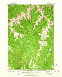
1940 Map of Mt Wallace
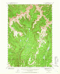
USGS Topo · Published 1963About this map
Gallatin National Forest and the northern border of Yellowstone National Park meet in this high-altitude survey of Park County. The landscape is defined by its drainages and peaks, including the prominent Mt Wallace and Hummingbird Peak. Early administrative presence is visible at the Hellroaring Ranger Station and Buffalo Fork Ranger Station, while the Bull Moose Cabin marks a remote outpost along West Fork. High mountain basins like Silver Basin, Clover Basin, and Hummingbird Basin gather snowmelt for the complex network of creeks that flow toward the Boulder River. Of particular interest to historical researchers is the Poacher Trail winding through the southern mountains, indicating established routes used before or during the expansion of the park system. The map also documents the unique geography of The Hole and the distinct elevation of Niggerhead Butte overlooking Buffalo Creek.
Find a feature on this map
59 named features on this map. Tap any name to fly to it.
Don’t see what you’re looking for? This feature index may not catch every label — zoom into the map to look around manually.
Map Details
Editions of this 1940 Mt Wallace Map
3 editions found

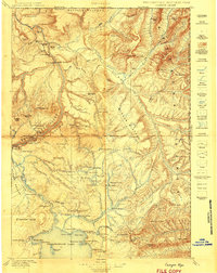
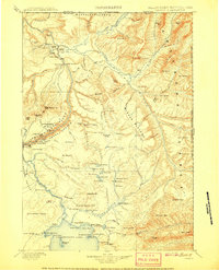
Other maps of this area

1885 · Gallatin
USGS Topo · 1:125,000

1885 · Gallatin
USGS Topo · 1:125,000

1886 · Canyon
USGS Topo · 1:125,000

1891 · Livingston
USGS Topo · 1:250,000

1893 · Livingston
USGS Topo · 1:250,000

1895 · Canyon
USGS Topo · 1:125,000
1896 · Canyon
USGS Topo · 1:125,000

1901 · Canyon
USGS Topo · 1:125,000

1901 · Gallatin
USGS Topo · 1:125,000
1907 · Canyon
USGS Topo · 1:125,000