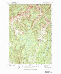
1940 Map of Mt Wallace
USGS Topo · Published 1984About this map
Gallatin National Forest and Yellowstone National Park converge in this high-altitude survey of the Gallatin Range and Absaroka Range. The landscape is dominated by peaks like Mt Wallace and Iron Mtn, with drainage basins feeding the Boulder River and Buffalo Fork. An interesting administrative detail appears along the southern edge, where the margin notes that the 45th parallel marks the Montana-Wyoming boundary, though the actual ground position was unknown during the survey. Human presence is limited to remote outposts such as the Hellroaring Ranger Station, Buffalo Fork Ranger Station, and Bull Moose Cabin, reflecting the era's focus on wilderness management and fire protection in the northern Rockies. The network of drainage features like Hellroaring Creek and Specimen Creek illustrates the complex hydrology of the region before modern development.
Find a feature on this map
56 named features on this map. Tap any name to fly to it.
Don’t see what you’re looking for? This feature index may not catch every label — zoom into the map to look around manually.
Map Details
Editions of this 1940 Mt Wallace Map
3 editions found

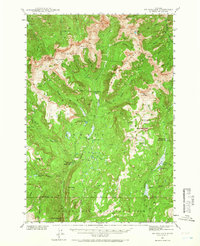
Other maps of this area

1885 · Gallatin
USGS Topo · 1:125,000

1885 · Gallatin
USGS Topo · 1:125,000

1886 · Canyon
USGS Topo · 1:125,000

1891 · Livingston
USGS Topo · 1:250,000

1893 · Livingston
USGS Topo · 1:250,000

1895 · Canyon
USGS Topo · 1:125,000

1896 · Canyon
USGS Topo · 1:125,000

1901 · Canyon
USGS Topo · 1:125,000

1901 · Gallatin
USGS Topo · 1:125,000

1907 · Canyon
USGS Topo · 1:125,000