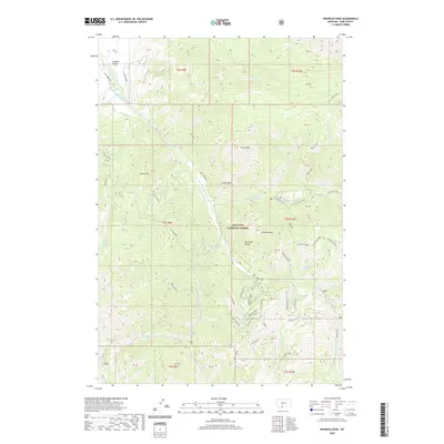
2020 Map of Knowles Peak
USGS Topo · Published 2020About this map
Knowles Peak and the high elevations of the Absaroka Range dominate this portion of the Gallatin National Forest. The landscape is defined by its dramatic verticality, dropping from peaks like Arrow Peak and Castle Rock into the headwaters of the drainage system. Water management is evident along the western edge where the Mill Cr Flat Ditch diverts water near Paradise Valley. The map reveals a complex network of named ridges and summits, including Anderson Ridge and Green Mtn, which frame the deep-cut valleys of Mill Cr and Wicked Creek. Notable landmarks such as Montanapolis Springs and the remote Elbow Lake suggest the historical and recreational utility of this high-country terrain. Ancient transit routes are marked by Wallace Pass, while resource access is hinted at by the presence of Bulldozer and Upper Snowbank roads.
Find a feature on this map
47 named features on this map. Tap any name to fly to it.
Don’t see what you’re looking for? This feature index may not catch every label — zoom into the map to look around manually.
Map Details
Editions of this 2020 Knowles Peak Map
This is the sole edition of this map. No revisions or reprints were ever made.
Other maps of this area

1891 · Livingston
USGS Topo · 1:250,000

1893 · Livingston
USGS Topo · 1:250,000

1940 · Mt. Cowen
USGS Topo · 1:62,500

1940 · Mt Wallace
USGS Topo · 1:62,500

1943 · Mt Wallace
USGS Topo · 1:62,500

1943 · Mt Cowen
USGS Topo · 1:62,500

1947 · Bozeman
USGS Topo · 1:250,000

1948 · Bozeman
USGS Topo · 1:250,000

1955 · Bozeman
USGS Topo · 1:250,000

1955 · Emigrant
USGS Topo · 1:62,500