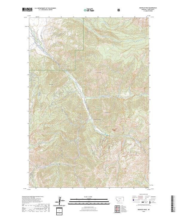
2024 Map of Knowles Peak
USGS Topo · Published 2024About this map
Knowles Peak and Arrow Peak dominate the high-altitude terrain within this section of the Absaroka Range, situated where the Gallatin National Forest meets the Absaroka-Beartooth Wilderness. The landscape is defined by a complex drainage system feeding into Mill Creek, including West Fork Mill Creek and East Fork Mill Creek. This area illustrates the management of montane water resources, evidenced by the Mill Creek Flat Ditch and numerous named tributaries like Counts Creek and Davis Creek. The map provides a detailed view of the trail networks that facilitate movement through these remote heights, such as the Elbow Lake Trl and Wallace Pass Trl. Specific alpine sites like Upper Snowbank and Wet Snow hint at the seasonal environmental conditions that govern this wilderness area, while markers like Clarks identify localized named points of interest.
Find a feature on this map
45 named features on this map. Tap any name to fly to it.
Don’t see what you’re looking for? This feature index may not catch every label — zoom into the map to look around manually.
Map Details
Editions of this 2024 Knowles Peak Map
This is the sole edition of this map. No revisions or reprints were ever made.
Other maps of this area

1891 · Livingston
USGS Topo · 1:250,000

1893 · Livingston
USGS Topo · 1:250,000

1940 · Mt. Cowen
USGS Topo · 1:62,500

1940 · Mt Wallace
USGS Topo · 1:62,500

1943 · Mt Wallace
USGS Topo · 1:62,500

1943 · Mt Cowen
USGS Topo · 1:62,500

1947 · Bozeman
USGS Topo · 1:250,000

1948 · Bozeman
USGS Topo · 1:250,000

1955 · Bozeman
USGS Topo · 1:250,000

1955 · Emigrant
USGS Topo · 1:62,500