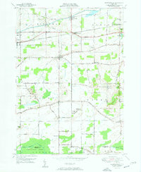
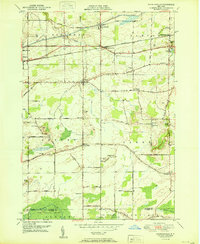
1950 Map of Knowlesville
USGS Topo · Published 1950About this map
The Erie Canal cuts through the northern landscape of Orleans County, defining the transport corridor that shaped settlements like Knowlesville and Medina. In this mid-century period, the New York Central railroad parallels the historic waterway, with specialized stops at Knowlesville Sta and Eagle Harbor Sta serving the agricultural hinterland. The map provides a detailed view of the rural school system before widespread consolidation, marking structures like School No 5 and School No 8 across the townships of Ridgeway and Barre.
Find a feature on this map
47 named features on this map. Tap any name to fly to it.
Don’t see what you’re looking for? This feature index may not catch every label — zoom into the map to look around manually.
Map Details
Editions of this 1950 Knowlesville Map
3 editions found
Other maps of this area

1897 · Albion
USGS Topo · 1:62,500

1897 · Medina
USGS Topo · 1:62,500

1897 · Oak Orchard
USGS Topo · 1:62,500

1897 · Ridgeway
USGS Topo · 1:62,500

1944 · Ashwood
USGS Topo · 1:31,680

1944 · Albion
USGS Topo · 1:31,680

1949 · Kendall
USGS Topo · 1:62,500
1949 · Akron
USGS Topo · 1:24,000
1949 · Medina
USGS Topo · 1:24,000
1950 · Knowlesville
USGS Topo · 1:24,000