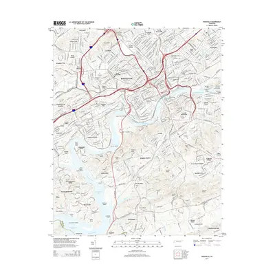
2014 Map of Knoxville
USGS Topo · Published 2014About this map
Knoxville dominates this 2014 survey, which reveals the dense urban fabric and sprawling suburban reach of the city along the Tennessee River. The landscape is defined by its topographic ridges and river bends, where historic neighborhoods like Lonsdale, Bearden, and Sequoyah Hills are situated alongside modern infrastructure. The central riverfront features iconic spans such as the Henley Street Bridge and Gay Street Bridge, providing vital links between the city core and south Knoxville. Significant institutional and industrial footprints are evident, from the extensive campus of The Univ of Tennessee to the Coster Yards rail facilities and the Knoxville Downtown Island Airport on Dickinson Island. Cultural and genealogical history is anchored by numerous large burial grounds, including the Old Gray Cem and the National Cem, reflecting generations of settlement within the Fort Loudoun Lake corridor.
Find a feature on this map
105 named features on this map. Tap any name to fly to it.
Don’t see what you’re looking for? This feature index may not catch every label — zoom into the map to look around manually.
Map Details
Editions of this 2014 Knoxville Map
This is the sole edition of this map. No revisions or reprints were ever made.
Other maps of this area

1886 · Knoxville
USGS Topo · 1:125,000

1892 · Knoxville
USGS Topo · 1:125,000

1893 · Briceville
USGS Topo · 1:125,000

1894 · Knoxville
USGS Topo · 1:125,000

1895 · Loudon
USGS Topo · 1:125,000

1895 · Briceville
USGS Topo · 1:125,000

1895 · Knoxville
USGS Topo · 1:125,000

1896 · Briceville
USGS Topo · 1:125,000

1897 · Maynardville
USGS Topo · 1:125,000

1900 · Maynardville
USGS Topo · 1:125,000