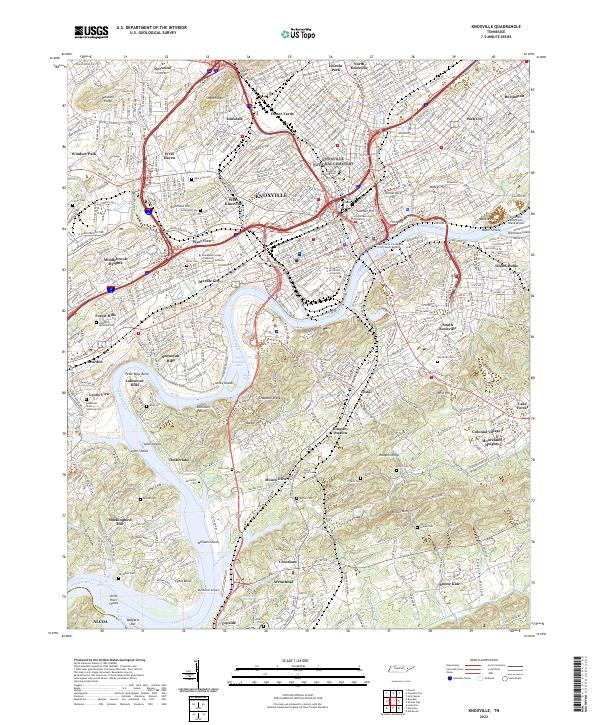
2022 Map of Knoxville
USGS Topo · Published 2022About this map
Knoxville serves as the focal point of this topographic study, where the Tennessee River snakes through a landscape defined by significant institutional and residential development. The map details the dense urban core, including the Knox County Courthouse City County Building and the extensive campus of The University of Tennessee Knoxville. To the north and west, neighborhoods like Lonsdale and West Haven give way to industrial corridors along the Southern RR and Coster Yards.
Find a feature on this map
93 named features on this map. Tap any name to fly to it.
Don’t see what you’re looking for? This feature index may not catch every label — zoom into the map to look around manually.
Map Details
Editions of this 2022 Knoxville Map
This is the sole edition of this map. No revisions or reprints were ever made.
Other maps of this area

1886 · Knoxville
USGS Topo · 1:125,000

1892 · Knoxville
USGS Topo · 1:125,000

1893 · Briceville
USGS Topo · 1:125,000

1894 · Knoxville
USGS Topo · 1:125,000

1895 · Loudon
USGS Topo · 1:125,000

1895 · Briceville
USGS Topo · 1:125,000

1895 · Knoxville
USGS Topo · 1:125,000

1896 · Briceville
USGS Topo · 1:125,000

1897 · Maynardville
USGS Topo · 1:125,000

1900 · Maynardville
USGS Topo · 1:125,000