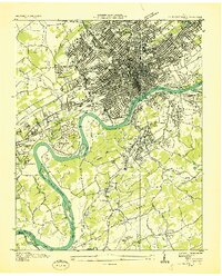
1936 Map of Knoxville
USGS Topo · Published 1936About this map
The Tennessee River snakes through the heart of this mid-1930s landscape, serving as the literal and economic divide between the dense urban grid of Knoxville and the developing suburbs of South Knoxville and Vestal. This survey, a collaboration between the U. S. Geological Survey and the Tennessee Valley Authority, highlights a city in transition. The industrial character of the era is evident through features like the Brick Kilns and the U S Department of Agriculture Cotton Gin, while the educational and civic footprint is extensive, anchored by the University of Tennessee and Knoxville College.
Find a feature on this map
83 named features on this map. Tap any name to fly to it.
Don’t see what you’re looking for? This feature index may not catch every label — zoom into the map to look around manually.
Map Details
Editions of this 1936 Knoxville Map
This is the sole edition of this map. No revisions or reprints were ever made.
Other maps of this area

1886 · Knoxville
USGS Topo · 1:125,000

1892 · Knoxville
USGS Topo · 1:125,000

1893 · Briceville
USGS Topo · 1:125,000

1894 · Knoxville
USGS Topo · 1:125,000

1895 · Loudon
USGS Topo · 1:125,000

1895 · Briceville
USGS Topo · 1:125,000

1895 · Knoxville
USGS Topo · 1:125,000

1896 · Briceville
USGS Topo · 1:125,000

1897 · Maynardville
USGS Topo · 1:125,000

1900 · Maynardville
USGS Topo · 1:125,000