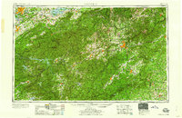
1960 Map of Knoxville
USGS Topo · Published 1960About this map
Knoxville and Asheville anchor this 1960 regional survey of the southern Appalachians, a landscape dominated by the massive crests of the Great Smoky Mountains and the Blue Ridge. The map documents a critical era of Tennessee Valley Authority water management, showing the established footprints of Douglas Lake, Fontana Lake, and Cherokee Lake amidst the high peaks. High elevations are punctuated by iconic summits like Clingmans Dome, Mt Mitchell, and Mt Le Conte.
Find a feature on this map
105 named features on this map. Tap any name to fly to it.
Don’t see what you’re looking for? This feature index may not catch every label — zoom into the map to look around manually.
Map Details
Editions of this 1960 Knoxville Map
2 editions found

Other maps of this area

1883 · Morristown
USGS Topo · 1:125,000

1886 · Knoxville
USGS Topo · 1:125,000

1886 · Dahlonega
USGS Topo · 1:125,000

1886 · Walhalla
USGS Topo · 1:125,000

1888 · Ellijay
USGS Topo · 1:125,000

1888 · Pickens
USGS Topo · 1:125,000

1891 · Cowee
USGS Topo · 1:125,000

1891 · Roan Mountain
USGS Topo · 1:125,000

1892 · Dahlonega
USGS Topo · 1:125,000

1892 · Walhalla
USGS Topo · 1:125,000