
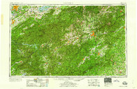
1960 Map of Knoxville
USGS Topo · Published 1960About this map
The Great Smoky Mountains and the massive timberlands of the Nantahala National Forest dominate this mid-century view of the Southern Appalachians. The landscape is defined by the high peaks of Clingmans Dome and Mt Mitchell, anchoring a region of dramatic verticality and deep river valleys. Human activity is concentrated in the burgeoning mountain hubs of Asheville and Knoxville, connected by the winding Blue Ridge Parkway and critical rail corridors like the Southern RR.
Find a feature on this map
86 named features on this map. Tap any name to fly to it.
Don’t see what you’re looking for? This feature index may not catch every label — zoom into the map to look around manually.
Map Details
Editions of this 1960 Knoxville Map
2 editions found
Other maps of this area

1883 · Morristown
USGS Topo · 1:125,000

1886 · Knoxville
USGS Topo · 1:125,000

1886 · Dahlonega
USGS Topo · 1:125,000

1886 · Walhalla
USGS Topo · 1:125,000

1888 · Ellijay
USGS Topo · 1:125,000

1888 · Pickens
USGS Topo · 1:125,000

1891 · Cowee
USGS Topo · 1:125,000

1891 · Roan Mountain
USGS Topo · 1:125,000

1892 · Dahlonega
USGS Topo · 1:125,000

1892 · Walhalla
USGS Topo · 1:125,000