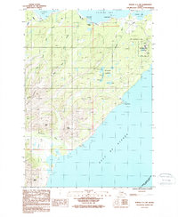
1987 Map of Kodiak C-1 SW
USGS Topo · Published 1988About this map
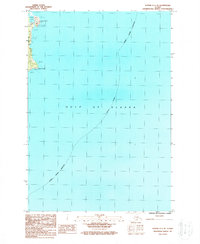
US Coast Guard Reservation occupies the northeastern tip of this coastal landscape on Kodiak Island, where the Gulf of Alaska meets the protected waters of Chiniak Bay. A series of astronomical-themed water bodies known as the Hidden Lakes—including Neptune, Uranus, Saturn, and Jupiter—sit tucked behind the coastline near Sequel Point. The interior is defined by the high ridges of the Marin Range, featuring prominent elevations such as Boyer Peak, Slope Peak, and Twin Peaks. Transportation is largely restricted to the Chiniak Road and the coastal corridor near Chiniak Point. This 1980s-era documentation reflects the strategic and maritime importance of the region, evidenced by the established military reservation and the Radio Tower marking the eastern headlands. Drainage patterns are dominated by the Sacramento River and Twin Creek, which cut through the steep topography to reach the sea.
Find a feature on this map
26 named features on this map. Tap any name to fly to it.
Don’t see what you’re looking for? This feature index may not catch every label — zoom into the map to look around manually.
Map Details
Editions of this 1987 Kodiak C-1 SW Map
This is the sole edition of this map. No revisions or reprints were ever made.
Other maps of this area

1949 · Kodiak C-2
USGS Topo · 1:63,360

1949 · Kodiak B-1 and B-2
USGS Topo · 1:63,360

1949 · Kodiak C-1
USGS Topo · 1:63,360

1951 · Kodiak B-1 and B-2
USGS Topo · 1:63,360

1951 · Kodiak C-1
USGS Topo · 1:63,360

1952 · Kodiak
USGS Topo · 1:250,000
1987 · Kodiak C-2 NE
USGS Topo · 1:25,000
1987 · Kodiak C-1 NW
USGS Topo · 1:25,000
1987 · Kodiak B-2 NE
USGS Topo · 1:25,000
1987 · Kodiak C-1 SE
USGS Topo · 1:25,000