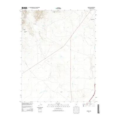
2013 Map of Koehler
USGS Topo · Published 2013About this map
Koehler sits at the foot of the Sangre de Cristo Mountains, where high-country canyons meet the expanse of the plains. This 2013 survey illustrates a landscape defined by water management and aviation, dominated by the long path of the Eagle Tail Canal and the Springer Arroyo as they wind toward the lowlands. The drainage systems of Crow Cr and Curtis Creek carve through the terrain, while landmarks like Koehler Lake and Dorsey Lake provide distinct geographic anchors in this arid region.
Find a feature on this map
22 named features on this map. Tap any name to fly to it.
Don’t see what you’re looking for? This feature index may not catch every label — zoom into the map to look around manually.
Map Details
Editions of this 2013 Koehler Map
This is the sole edition of this map. No revisions or reprints were ever made.
Other maps of this area

1912 · Raton
USGS Topo · 1:62,500

1914 · Raton
USGS Topo · 1:62,500

1915 · Brilliant
USGS Topo · 1:62,500

1915 · Koehler
USGS Topo · 1:62,500

1917 · Koehler
USGS Topo · 1:62,500

1954 · Raton
USGS Topo · 1:250,000

1958 · Raton
USGS Topo · 1:250,000

1971 · Clifton House
USGS Topo · 1:24,000

1971 · Saltpeter Mountain
USGS Topo · 1:24,000
1971 · Curtis Camp
USGS Topo · 1:24,000