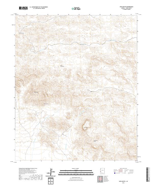
2021 Map of Kofa Butte
USGS Topo · Published 2021About this map
The Kofa Mountains dominate this high-desert landscape in Yuma County, characterized by a complex network of arid drainage systems and prominent peaks. The map reveals the dramatic vertical relief of the region, anchored by the namesake Kofa Butte and the elevation of Polaris Mtn to the west. This area is defined by its extreme topography, where traditional watercourses like Hoodoo Wash and Yaqui Wash carve through the terrain, indicating a landscape shaped by seasonal flash flooding rather than permanent water. Geologic and recreational landmarks are visible throughout the quadrangle, including a Natural Arch and the narrow passage of Big Horn Pass. These features, alongside isolated drainage points like Kofa Dam Wash, provide essential context for those studying the physical geography of the Arizona desert or tracing movement through the Moonshine Gulch area.
Find a feature on this map
14 named features on this map. Tap any name to fly to it.
Don’t see what you’re looking for? This feature index may not catch every label — zoom into the map to look around manually.
Map Details
Editions of this 2021 Kofa Butte Map
This is the sole edition of this map. No revisions or reprints were ever made.
Other maps of this area

1942 · Blythe
USGS Topo · 1:250,000

1942 · Vicksburg
USGS Topo · 1:250,000

1954 · Salton Sea
USGS Topo · 1:250,000

1954 · Phoenix
USGS Topo · 1:250,000

1955 · Salton Sea
USGS Topo · 1:250,000

1957 · Phoenix
USGS Topo · 1:250,000

1958 · Phoenix
USGS Topo · 1:250,000

1959 · Salton Sea
USGS Topo · 1:250,000

1960 · Phoenix
USGS Topo · 1:250,000

1962 · Kofa Butte
USGS Topo · 1:62,500