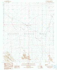
1990 Map of Kofa Deep Well
USGS Topo · Published 1990About this map
Kofa National Wildlife Refuge dominates this desert landscape in Yuma County, capturing the arid expanse of the King Valley as it appeared in the late 20th century. The terrain is defined by the sharp transition from the valley floor to the prominent peaks of the Castle Dome Mountains in the southwest corner. Human presence is sparse, marked primarily by essential water sources and remote landmarks such as Kofa Deep Well and the Rob Roy site. These features, along with Little White Tanks and Figueroa Tank, highlight the critical importance of water management in this environment. The King Road provides the primary transit corridor through the refuge, connecting these isolated points across the open desert. This document preserves the topographical details of a protected wilderness area during a period of limited revision and field checks, offering a precise look at the drainage patterns and landforms of the Arizona desert.
Find a feature on this map
12 named features on this map. Tap any name to fly to it.
Don’t see what you’re looking for? This feature index may not catch every label — zoom into the map to look around manually.
Map Details
Editions of this 1990 Kofa Deep Well Map
This is the sole edition of this map. No revisions or reprints were ever made.
Other maps of this area

1942 · Blythe
USGS Topo · 1:250,000

1942 · Vicksburg
USGS Topo · 1:250,000

1954 · Salton Sea
USGS Topo · 1:250,000

1954 · Phoenix
USGS Topo · 1:250,000

1955 · Salton Sea
USGS Topo · 1:250,000

1957 · Phoenix
USGS Topo · 1:250,000

1958 · Phoenix
USGS Topo · 1:250,000

1959 · Salton Sea
USGS Topo · 1:250,000

1960 · Phoenix
USGS Topo · 1:250,000

1962 · Kofa Butte
USGS Topo · 1:62,500