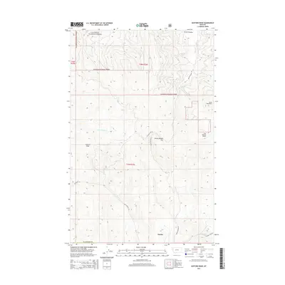
2014 Map of Kofford Ridge
USGS Topo · Published 2014About this map
Niarada sits at the southern edge of this 2014 survey, where the valley floor transitions into the complex topography of the Salish Mountains and the Hog Heaven Range. Much of the northern terrain is managed as the Flathead National Forest, characterized by steep drainage systems like Little Meadow Cr and Sullivan Cr. The map reveals a network of mountain transit corridors, most notably the Browns Meadow Rd which winds through Browns Meadow Pass. This area is defined by its industrial and natural geography, evidenced by the presence of the Flathead Mine Rd leading into the heights. Notable landmarks such as Kofford Ridge and the secluded Welcome Spring provide specific reference points for those tracing the history of land use and resource extraction in this part of Flathead County.
Find a feature on this map
21 named features on this map. Tap any name to fly to it.
Don’t see what you’re looking for? This feature index may not catch every label — zoom into the map to look around manually.
Map Details
Editions of this 2014 Kofford Ridge Map
This is the sole edition of this map. No revisions or reprints were ever made.
Other maps of this area

1920 · Flathead Lake
USGS Topo · 1:125,000

1943 · Kalispell
USGS Topo · 1:125,000

1956 · Wallace
USGS Topo · 1:250,000

1957 · Kalispell
USGS Topo · 1:250,000

1960 · Kalispell
USGS Topo · 1:250,000

1960 · Wallace
USGS Topo · 1:250,000

1961 · Kalispell
USGS Topo · 1:250,000

1962 · Kila
USGS Topo · 1:24,000

1964 · Irvine Lookout Tower
USGS Topo · 1:24,000
1964 · Lake Mary Ronan
USGS Topo · 1:24,000