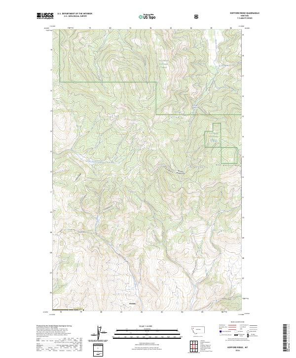
2024 Map of Kofford Ridge
USGS Topo · Published 2024About this map
Niarada sits at the southern edge of this West Central Montana landscape, marking a transition between the open valley floor and the rising heights of the Hog Heaven Range. Much of the northern terrain is defined by the protected boundaries of the Flathead National Forest, where a network of forest service and mining roads suggests a history of resource extraction and timber management. High points like Kofford Ridge overlook a complex drainage system including Sullivan Creek and Little Meadow Creek, which carve through the varied topography. The presence of Flathead Mine Rd pointing toward the interior mountains highlights the region's industrial ties, while local access routes like Browns Meadow Rd and Battle Butte Rd link the high country back to the settlement at the county line.
Find a feature on this map
20 named features on this map. Tap any name to fly to it.
Don’t see what you’re looking for? This feature index may not catch every label — zoom into the map to look around manually.
Map Details
Editions of this 2024 Kofford Ridge Map
This is the sole edition of this map. No revisions or reprints were ever made.
Other maps of this area

1920 · Flathead Lake
USGS Topo · 1:125,000

1943 · Kalispell
USGS Topo · 1:125,000

1956 · Wallace
USGS Topo · 1:250,000

1957 · Kalispell
USGS Topo · 1:250,000

1960 · Kalispell
USGS Topo · 1:250,000

1960 · Wallace
USGS Topo · 1:250,000

1961 · Kalispell
USGS Topo · 1:250,000

1962 · Kila
USGS Topo · 1:24,000

1964 · Irvine Lookout Tower
USGS Topo · 1:24,000
1964 · Lake Mary Ronan
USGS Topo · 1:24,000