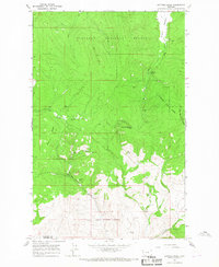
1964 Map of Kofford Ridge
USGS Topo · Published 1967About this map
The silver and lead mining operations of the Hog Heaven Range define the central landscape of this 1964 survey. In the hills above Sullivan Creek, several significant industrial sites are documented, including the Flathead Mine, West Flathead Mine, and the Mary Ann Mine. This concentrated mining activity, including the Battle Butte Mine and Martin Mine further south, represents a key period in the mineral development of Flathead County.
Find a feature on this map
20 named features on this map. Tap any name to fly to it.
Don’t see what you’re looking for? This feature index may not catch every label — zoom into the map to look around manually.
Map Details
Editions of this 1964 Kofford Ridge Map
This is the sole edition of this map. No revisions or reprints were ever made.
Other maps of this area

1920 · Flathead Lake
USGS Topo · 1:125,000

1943 · Kalispell
USGS Topo · 1:125,000

1956 · Wallace
USGS Topo · 1:250,000

1957 · Kalispell
USGS Topo · 1:250,000

1960 · Kalispell
USGS Topo · 1:250,000

1960 · Wallace
USGS Topo · 1:250,000

1961 · Kalispell
USGS Topo · 1:250,000

1962 · Kila
USGS Topo · 1:24,000

1964 · Irvine Lookout Tower
USGS Topo · 1:24,000
1964 · Lake Mary Ronan
USGS Topo · 1:24,000