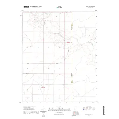
2023 Map of Koger Ranch
USGS Topo · Published 2023About this map
Tramperos Creek meanders across this high plains landscape at the border of New Mexico and Texas. This 2023 survey of the Koger Ranch area in Union County reveals a remote ranching territory defined by its drainage systems and a sparse network of county roads. The terrain is marked by the distinct canyon-like carvings of Punta de Agua Creek in the eastern portion, providing a stark contrast to the surrounding plateau. A series of local transit routes such as Tompkins Rd, Kroger Rd, and Romero Rd serve the disparate ranching parcels. The presence of Wcha Rd and various section lines illustrates the enduring importance of the Public Land Survey System in organizing this arid landscape, where water features and boundary lines dictate the pattern of human activity.
Find a feature on this map
19 named features on this map. Tap any name to fly to it.
Don’t see what you’re looking for? This feature index may not catch every label — zoom into the map to look around manually.
Map Details
Editions of this 2023 Koger Ranch Map
This is the sole edition of this map. No revisions or reprints were ever made.
Other maps of this area

1954 · Tucumcari
USGS Topo · 1:250,000

1954 · Dalhart
USGS Topo · 1:250,000

1958 · Tucumcari
USGS Topo · 1:250,000

1958 · Dalhart
USGS Topo · 1:250,000

1962 · Dalhart
USGS Topo · 1:250,000

1970 · Stead
USGS Topo · 1:24,000

1970 · Sedan SE
USGS Topo · 1:24,000

1971 · Koger Ranch
USGS Topo · 1:24,000

1971 · Centerville Corner
USGS Topo · 1:24,000

1971 · Amistad SE
USGS Topo · 1:24,000