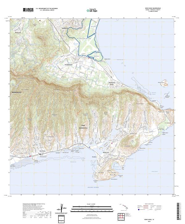
2024 Map of Koko Head
USGS Topo · Published 2024About this map
The Ko'olau Range anchors the dramatic landscape of East O'ahu, where steep ridges and deep valleys meet the shoreline of Maunalua Bay. This modern survey illustrates the residential expansion of Hawai'i Kai and Portlock, contrasting the densely developed valleys of East Honolulu with the military and recreational lands of MC TRNG AREA Bellows to the north. Geologic features like the Ka'au Crater and the distinct volcanic tuff cone forming Hanauma Bay define the southern coast, alongside the Toilet Bowl and Witches Brew. Genealogists and local historians can find landmarks such as the Memorial Garden at the Church of the Holy Nativity in 'Aina Haina, while the transition from inland Maunawili to the coastal Waimanalo Beach shows the ongoing evolution of these island communities.
Find a feature on this map
91 named features on this map. Tap any name to fly to it.
Don’t see what you’re looking for? This feature index may not catch every label — zoom into the map to look around manually.
Map Details
Editions of this 2024 Koko Head Map
This is the sole edition of this map. No revisions or reprints were ever made.
Other maps of this area

1952 · Koko Head
USGS Topo · 1:24,000

1952 · Mokapu
USGS Topo · 1:24,000

1953 · Honolulu
USGS Topo · 1:24,000

1954 · Oahu
USGS Topo · 1:250,000

1954 · Kaneohe
USGS Topo · 1:24,000

1959 · Mokapu
USGS Topo · 1:24,000

1959 · Koko Head
USGS Topo · 1:24,000

1959 · Kaneohe
USGS Topo · 1:24,000

1959 · Honolulu
USGS Topo · 1:24,000

1961 · Oahu
USGS Topo · 1:250,000