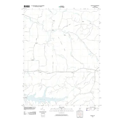
2010 Map of Koleen
USGS Topo · Published 2010About this map
Greenwood Lake dominates the southern landscape of this Greene County quadrangle, where the creek valleys of southern Indiana meet family-owned ridges and upland hollows. The settlement of Koleen serves as a central point along Plummer Creek, while Doans anchors the southwestern portion of the sheet near Doans Creek. The terrain is defined by named rises such as Taylor Ridge and Haney Ridge, alongside the curiously named Hard Scrabble Ridge.
Find a feature on this map
70 named features on this map. Tap any name to fly to it.
Don’t see what you’re looking for? This feature index may not catch every label — zoom into the map to look around manually.
Map Details
Editions of this 2010 Koleen Map
This is the sole edition of this map. No revisions or reprints were ever made.
Other maps of this area

1908 · Bloomington
USGS Topo · 1:48,000

1908 · Bloomfield
USGS Topo · 1:62,500

1910 · Bloomington
USGS Topo · 1:62,500

1935 · Oolitic
USGS Topo · 1:48,000

1942 · Oolitic
USGS Topo · 1:62,500

1950 · Odon
USGS Topo · 1:24,000

1951 · Bloomfield
USGS Topo · 1:24,000

1953 · Indianapolis
USGS Topo · 1:250,000

1956 · Indianapolis
USGS Topo · 1:250,000
1956 · Stanford
USGS Topo · 1:24,000