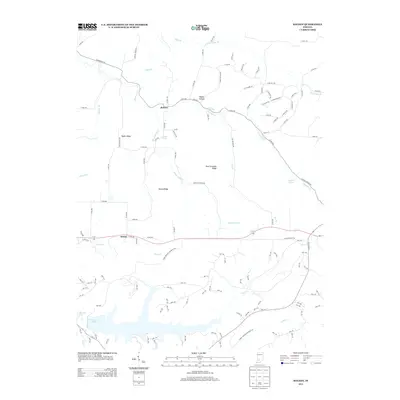
2013 Map of Koleen
USGS Topo · Published 2013About this map
Plummer Creek and its many tributaries, including Flyblow Branch and Clifty Branch, define the drainage patterns across this Greene County landscape. The settlement of Koleen sits at a crossroads in the northern section, while Doans anchors the central region along Doans Creek. The terrain is characterized by a series of prominent rises such as Taylor Ridge, Haney Ridge, and the aptly named Hard Scrabble Ridge. In the south, the waters of Greenwood Lake and Oberlin Lake dominate the geography, fed by First Creek. Local history is preserved in the names of natural landmarks like Rock Springs, Rankin Spring, and Osborne Spring, which likely served as vital water sources for early residents. The map captures a detailed network of rural routes, from Piankeshaw Trail to numerous named county roads that connect these dispersed communities and topographic features.
Find a feature on this map
131 named features on this map. Tap any name to fly to it.
Don’t see what you’re looking for? This feature index may not catch every label — zoom into the map to look around manually.
Map Details
Editions of this 2013 Koleen Map
This is the sole edition of this map. No revisions or reprints were ever made.
Other maps of this area

1908 · Bloomington
USGS Topo · 1:48,000

1908 · Bloomfield
USGS Topo · 1:62,500

1910 · Bloomington
USGS Topo · 1:62,500

1935 · Oolitic
USGS Topo · 1:48,000

1942 · Oolitic
USGS Topo · 1:62,500

1950 · Odon
USGS Topo · 1:24,000

1951 · Bloomfield
USGS Topo · 1:24,000

1953 · Indianapolis
USGS Topo · 1:250,000

1956 · Indianapolis
USGS Topo · 1:250,000
1956 · Stanford
USGS Topo · 1:24,000