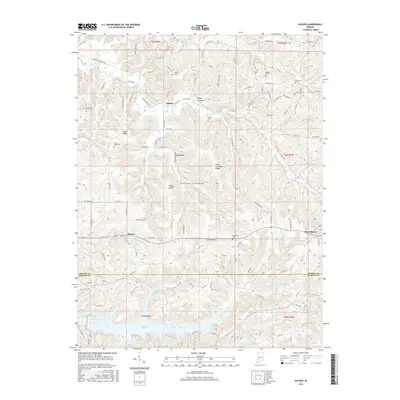
2016 Map of Koleen
USGS Topo · Published 2016About this map
Koleen, Doans, and Owensburg anchor this 2016 topographical landscape where the hills of Greene and Martin counties converge. The terrain is defined by prominent ridges such as Taylor Ridge, Haney Ridge, and Hard Scrabble Ridge, which dictate the local road network and separate the drainage basins of Plummer Cr and Doans Cr. Genealogists will find a high density of rural burial grounds, including Howell Cem, Cooper Cem, and Wagoner Cem, often positioned on the higher elevations or near historic homesteads. In the southern portion of the sheet, the waters of Greenwood Lake and Oberlin Lake contrast with the northern landscape of springs and branches like Rock Springs and Clifty Branch. This map shows a predominantly rural area where the naming of small hollows like Happy Hollow and springs like Rankin Spring reflects a deep-rooted local geography that persists into the 21st century.
Find a feature on this map
130 named features on this map. Tap any name to fly to it.
Don’t see what you’re looking for? This feature index may not catch every label — zoom into the map to look around manually.
Map Details
Editions of this 2016 Koleen Map
This is the sole edition of this map. No revisions or reprints were ever made.
Other maps of this area

1908 · Bloomington
USGS Topo · 1:48,000

1908 · Bloomfield
USGS Topo · 1:62,500

1910 · Bloomington
USGS Topo · 1:62,500

1935 · Oolitic
USGS Topo · 1:48,000

1942 · Oolitic
USGS Topo · 1:62,500

1950 · Odon
USGS Topo · 1:24,000

1951 · Bloomfield
USGS Topo · 1:24,000

1953 · Indianapolis
USGS Topo · 1:250,000

1956 · Indianapolis
USGS Topo · 1:250,000
1956 · Stanford
USGS Topo · 1:24,000