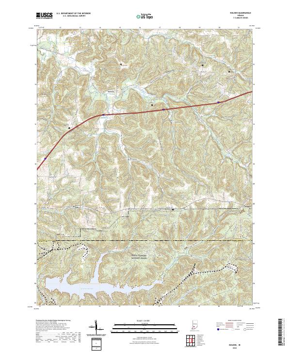
2022 Map of Koleen
USGS Topo · Published 2022About this map
Koleen and Doans anchor this Greene County landscape, where the southern reaches of the township meet the Greene and Martin County line. The terrain is defined by a series of prominent ridges, including Taylor Ridge, Haney Ridge, and the sharply named Hard Scrabble Ridge, which dictate the winding paths of rural routes like Sassafras Rd and Hickory Rd. Numerous family and community cemeteries are scattered across the uplands, such as Howell Cem, Robinson Cem, and Wollam Cem, offering a clear map for genealogical research in the area.
Find a feature on this map
130 named features on this map. Tap any name to fly to it.
Don’t see what you’re looking for? This feature index may not catch every label — zoom into the map to look around manually.
Map Details
Editions of this 2022 Koleen Map
This is the sole edition of this map. No revisions or reprints were ever made.
Other maps of this area

1908 · Bloomington
USGS Topo · 1:48,000

1908 · Bloomfield
USGS Topo · 1:62,500

1910 · Bloomington
USGS Topo · 1:62,500

1935 · Oolitic
USGS Topo · 1:48,000

1942 · Oolitic
USGS Topo · 1:62,500

1950 · Odon
USGS Topo · 1:24,000

1951 · Bloomfield
USGS Topo · 1:24,000

1953 · Indianapolis
USGS Topo · 1:250,000

1956 · Indianapolis
USGS Topo · 1:250,000
1956 · Stanford
USGS Topo · 1:24,000