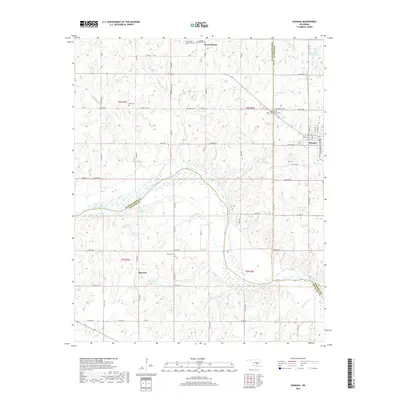
2018 Map of Konawa
USGS Topo · Published 2018About this map
Sacred Heart and its historic mission grounds anchor the northern portion of this landscape, situated where Pottawatomie and Seminole counties meet. This area is notably rich in early burial sites, including the Sacred Heart Cem, Abbey Cem, and the nearby Lyon's Cem. To the east, the city of Konawa serves as a local hub, its residential grid defined by streets like N Division St and Main St.
Find a feature on this map
85 named features on this map. Tap any name to fly to it.
Don’t see what you’re looking for? This feature index may not catch every label — zoom into the map to look around manually.
Map Details
Editions of this 2018 Konawa Map
This is the sole edition of this map. No revisions or reprints were ever made.
Other maps of this area

1896 · Seminole and Prague
USGS Topo · 1:125,000

1901 · Stonewall
USGS Topo · 1:125,000

1907 · Maud
USGS Topo · 1:62,500

1908 · Maud
USGS Topo · 1:62,500

1954 · Oklahoma City
USGS Topo · 1:250,000

1957 · Ardmore
USGS Topo · 1:250,000

1957 · Oklahoma City
USGS Topo · 1:250,000
1958 · Pearson
USGS Topo · 1:24,000

1958 · Ada
USGS Topo · 1:24,000

1958 · Vamoosa
USGS Topo · 1:24,000