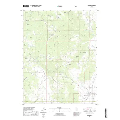
2020 Map of Koosharem
USGS Topo · Published 2020About this map
Koosharem serves as the primary settlement on this Sevier County survey, situated in the Grass Valley area where the Koosharem Canal and Koosharem Cr support local agriculture. The town plan is clearly defined by its street grid, featuring Main St and a dedicated Po. To the north, the terrain rises into the Fishlake National Forest, a landscape of high plateaus and distinct volcanic or erosional landforms like Devils Castle and Tabernacle Ridge.
Find a feature on this map
96 named features on this map. Tap any name to fly to it.
Don’t see what you’re looking for? This feature index may not catch every label — zoom into the map to look around manually.
Map Details
Editions of this 2020 Koosharem Map
This is the sole edition of this map. No revisions or reprints were ever made.
Other maps of this area

1885 · Beaver
USGS Topo · 1:250,000

1885 · Fish Lake
USGS Topo · 1:250,000

1896 · Fish Lake
USGS Topo · 1:250,000

1940 · Monroe
USGS Topo · 1:62,500

1944 · Monroe
USGS Topo · 1:62,500

1945 · Marysvale
USGS Topo · 1:62,500

1947 · Marysvale
USGS Topo · 1:62,500

1953 · Richfield
USGS Topo · 1:250,000

1956 · Salina
USGS Topo · 1:250,000

1958 · Richfield
USGS Topo · 1:250,000