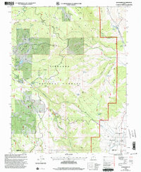
2001 Map of Koosharem
USGS Topo · Published 2003About this map
Koosharem sits at the edge of the high mountain terrain and the agricultural floor of Grass Valley in this survey updated at the turn of the 21st century. The landscape is defined by the steep transition from the Fishlake National Forest, where peaks like Monument Peak and Indian Peak tower over local landmarks such as Devils Castle and Tabernacle Ridge. This area shows a complex water management system essential for high-altitude ranching and farming, including the Magleby Reservoir and an Aqueduct feeding into the valley. For those tracing local history, the map identifies specific points of interest like the Koosharem Cem and the uniquely named Milos Kitchen. The terrain is marked by numerous springs such as Koosharem Pasture Spring and drainage systems like Greenwich Creek and Koosharem Creek, which illustrate the vital link between the forested uplands and the valley floor settlements.
Find a feature on this map
55 named features on this map. Tap any name to fly to it.
Don’t see what you’re looking for? This feature index may not catch every label — zoom into the map to look around manually.
Map Details
Editions of this 2001 Koosharem Map
This is the sole edition of this map. No revisions or reprints were ever made.
Other maps of this area

1885 · Beaver
USGS Topo · 1:250,000

1885 · Fish Lake
USGS Topo · 1:250,000

1896 · Fish Lake
USGS Topo · 1:250,000

1940 · Monroe
USGS Topo · 1:62,500

1944 · Monroe
USGS Topo · 1:62,500

1945 · Marysvale
USGS Topo · 1:62,500

1947 · Marysvale
USGS Topo · 1:62,500

1953 · Richfield
USGS Topo · 1:250,000

1956 · Salina
USGS Topo · 1:250,000

1958 · Richfield
USGS Topo · 1:250,000