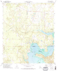
1972 Map of Koran
USGS Topo · Published 1973About this map
Lake Bistineau dominates the southeastern portion of this map, its shoreline irregular with points like Adam Point and Fairview Point and small landforms such as Plum Orchard Island. The settlement of Koran is located at the intersection of local roads west of the lake, serving as a hub for the surrounding rural area. This 1970s landscape is deeply marked by religious and community foundations, evidenced by the high density of small burial grounds and country churches. Genealogists can find several family-named or church-affiliated sites, including Gilmer Cem, Marshall Cem, and Suggs Cem. Recreation and infrastructure are also evident along the water, with Lake Bistineau State Park providing a Campground and Picnic Area, while a nearby Fish Hatchery and Compressor Station speak to the managed nature of the local environment during this era.
Find a feature on this map
42 named features on this map. Tap any name to fly to it.
Don’t see what you’re looking for? This feature index may not catch every label — zoom into the map to look around manually.
Map Details
Editions of this 1972 Koran Map
2 editions found
Other maps of this area

1932 · Bossier SE
USGS Topo · 1:31,680

1938 · Arnsberg
USGS Topo · 1:31,680

1941 · Bossier Point
USGS Topo · 1:31,680

1947 · Ringgold
USGS Topo · 1:62,500

1947 · Minden
USGS Topo · 1:62,500

1948 · Bossier City
USGS Topo · 1:62,500

1948 · Caspiana
USGS Topo · 1:62,500

1949 · Minden
USGS Topo · 1:62,500

1955 · Shreveport
USGS Topo · 1:250,000

1955 · Caspiana
USGS Topo · 1:62,500