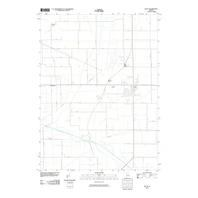
2010 Map of Kouts
USGS Topo · Published 2010About this map
Kouts sits as the primary settlement on this Indiana landscape, where the flat terrain of the Kankakee River valley is defined by an extensive network of drainage infrastructure. This grid of agricultural water management, including Sandy Hook Ditch, Jones Ditch, and Cornell Ditch, demonstrates the massive engineering efforts required to reclaim these wetlands for productive farming. The southern edge of the quadrangle is bounded by the Kankakee River itself, with Crooked Creek meandering through the lowlands nearby. For those looking into local lineage, the presence of Hopewell Mennonite Cemetery, Merriman Cemetery, and Graceland Cemetery provides essential geographic anchors for family history. The layout of the small community of Aylesworth and the crossroads at Five Points Corner show the enduring pattern of rural Indiana settlement during this modern era.
Find a feature on this map
53 named features on this map. Tap any name to fly to it.
Don’t see what you’re looking for? This feature index may not catch every label — zoom into the map to look around manually.
Map Details
Editions of this 2010 Kouts Map
This is the sole edition of this map. No revisions or reprints were ever made.
Other maps of this area

1953 · Palmer
USGS Topo · 1:24,000

1953 · Wanatah
USGS Topo · 1:24,000

1953 · Hebron
USGS Topo · 1:24,000

1953 · Valparaiso
USGS Topo · 1:24,000

1953 · Kouts
USGS Topo · 1:24,000

1953 · Chicago
USGS Topo · 1:250,000

1957 · Chicago
USGS Topo · 1:250,000

1957 · Wheatfield
USGS Topo · 1:24,000

1957 · DeMotte
USGS Topo · 1:24,000

1958 · La Crosse
USGS Topo · 1:24,000