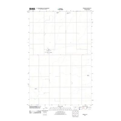
2011 Map of Kremlin
USGS Topo · Published 2011About this map
Kremlin serves as a concentrated hub of activity in the north-central Montana plains, centered around its local services and transport corridors. The settlement pattern here is dictated by the grid of the High Line, with the Kremlin Post Office and the Kremlin Rural Fire Dist anchoring the community. The surrounding landscape is defined by a series of dramatic northern drainages, including Wild Rose Coulee, Chain of Lakes Coulee, and Sprinkle Coulee, which cut through the agricultural sections. To the southwest, the Sorenson Airport indicates the importance of regional aviation in this expansive territory. A network of rural arteries like S Kremlin Rd and Chain Lake Rd provide the necessary links between isolated farmsteads and the central town, illustrating a landscape designed for large-scale ranching and wheat farming during the early 21st century.
Find a feature on this map
14 named features on this map. Tap any name to fly to it.
Don’t see what you’re looking for? This feature index may not catch every label — zoom into the map to look around manually.
Map Details
Editions of this 2011 Kremlin Map
This is the sole edition of this map. No revisions or reprints were ever made.
Other maps of this area

1904 · Assinniboine
USGS Topo · 1:62,500

1904 · Boxelder
USGS Topo · 1:62,500

1906 · Kremlin
USGS Topo · 1:62,500

1906 · Boxelder
USGS Topo · 1:62,500

1912 · Thibedeau Lake
USGS Topo · 1:125,000

1919 · Big Sandy
USGS Topo · 1:125,000

1920 · Gildford
USGS Topo · 1:125,000

1943 · Gildford
USGS Topo · 1:125,000

1953 · Havre
USGS Topo · 1:250,000

1954 · Shelby
USGS Topo · 1:250,000