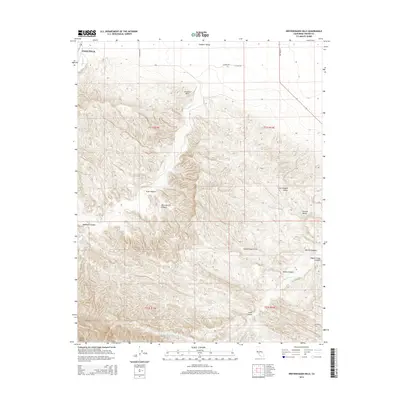
2015 Map of Kreyenhagen Hills
USGS Topo · Published 2015About this map
Pleasant Valley opens into the southeastern edge of Coalinga, marking a transition from the agricultural expanse of the San Joaquin Valley into the complex drainages of the Diablo Range. The landscape is defined by the namesake Kreyenhagen Hills and Jacalitos Hills, where seasonal watercourses like Warthan Cr, Jacalitos Cr, and Zapato Chino Cr have carved a series of distinct topographic features. These include the deep recesses of Deadman Canyon, Ruiz Canyon, and Pete Merrill Canyon. This 2015 survey illustrates the intersection of Fresno County's rugged western uplands with the valley floor, documenting the rural road network including S Merced Ave and S Alpine Ave as they navigate the varied elevations of the Central Valley margin.
Find a feature on this map
25 named features on this map. Tap any name to fly to it.
Don’t see what you’re looking for? This feature index may not catch every label — zoom into the map to look around manually.
Map Details
Editions of this 2015 Kreyenhagen Hills Map
This is the sole edition of this map. No revisions or reprints were ever made.
Other maps of this area

1912 · Coalinga
USGS Topo · 1:125,000

1914 · Cholame
USGS Topo · 1:125,000

1915 · Cholame
USGS Topo · 1:125,000

1917 · Cholame
USGS Topo · 1:125,000

1930 · Canoas Creek
USGS Topo · 1:31,680

1933 · Guijarral Hills
USGS Topo · 1:31,680

1934 · The Dark Hole
USGS Topo · 1:31,680

1934 · Reef Ridge
USGS Topo · 1:31,680

1934 · Canoas Creek
USGS Topo · 1:31,680

1936 · Kreyenhagen Hills
USGS Topo · 1:31,680