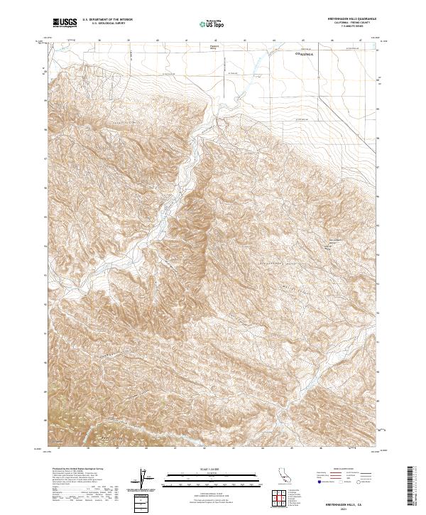
2021 Map of Kreyenhagen Hills
USGS Topo · Published 2021About this map
The Kreyenhagen Hills and Jacalitos Hills dominate this portion of the Diablo Range, where the high ridges of the California Coast Ranges descend into the western Central Valley. This area south of Coalinga is defined by a dense network of seasonal drainages and named canyons, including Pete Merrill Canyon, Garcia Canyon, and Deadman Canyon. The landscape shows a stark transition from the steep, folded terrain of Reef Ridge in the southwest to the alluvial floor of Pleasant Valley in the north.
Find a feature on this map
30 named features on this map. Tap any name to fly to it.
Don’t see what you’re looking for? This feature index may not catch every label — zoom into the map to look around manually.
Map Details
Editions of this 2021 Kreyenhagen Hills Map
This is the sole edition of this map. No revisions or reprints were ever made.
Other maps of this area

1912 · Coalinga
USGS Topo · 1:125,000

1914 · Cholame
USGS Topo · 1:125,000

1915 · Cholame
USGS Topo · 1:125,000

1917 · Cholame
USGS Topo · 1:125,000

1930 · Canoas Creek
USGS Topo · 1:31,680

1933 · Guijarral Hills
USGS Topo · 1:31,680

1934 · The Dark Hole
USGS Topo · 1:31,680

1934 · Reef Ridge
USGS Topo · 1:31,680

1934 · Canoas Creek
USGS Topo · 1:31,680

1936 · Kreyenhagen Hills
USGS Topo · 1:31,680