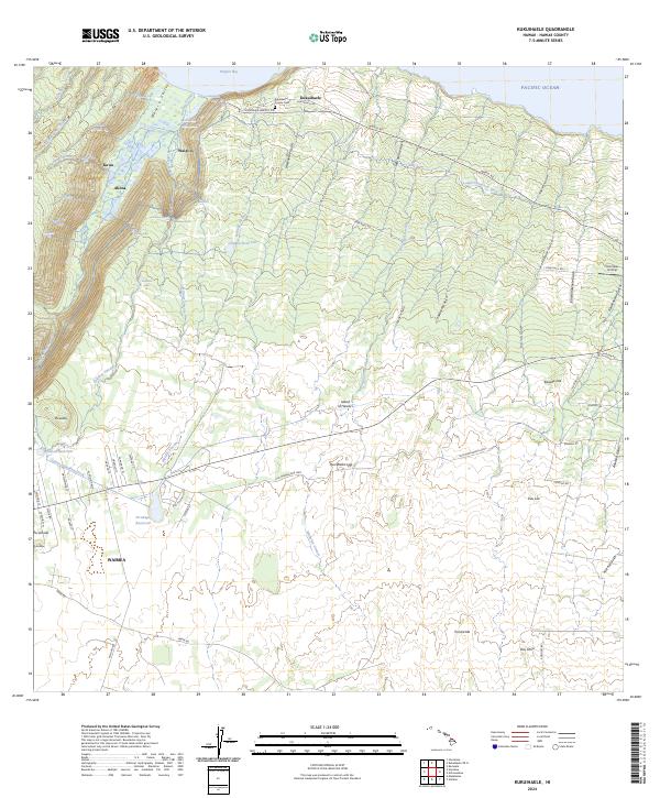
2024 Map of Kukuihaele
USGS Topo · Published 2024About this map
The dramatic cliffs and valleys of the Hamakua Coast are documented here, featuring the legendary Waipi‘o settlement and the deep Waipi‘o Valley. Water is the defining element of this landscape, from the coastal Lālākea Fishpond and Waipi‘o Bay to the numerous interior cascades including Hi‘ilawe Falls, Waimanu Falls, and Kekeha Falls. The map reveals a complex water management system essential to the region, including the Lower Hāmākua Ditch, Upper Hāmākua Ditch, and Lālākea Reservoir.
Find a feature on this map
79 named features on this map. Tap any name to fly to it.
Don’t see what you’re looking for? This feature index may not catch every label — zoom into the map to look around manually.
Map Details
Editions of this 2024 Kukuihaele Map
This is the sole edition of this map. No revisions or reprints were ever made.
Other maps of this area

1915 · Hamakua
USGS Topo · 1:62,500

1916 · Waipio
USGS Topo · 1:62,500

1954 · Hawaii North
USGS Topo · 1:250,000

1956 · Kamuela
USGS Topo · 1:24,000

1956 · Nohonaohae
USGS Topo · 1:24,000

1956 · Makahalau
USGS Topo · 1:24,000

1956 · Umikoa
USGS Topo · 1:24,000
1957 · Honokane
USGS Topo · 1:24,000

1957 · Honokaa
USGS Topo · 1:24,000

1959 · Hawaii North
USGS Topo · 1:250,000