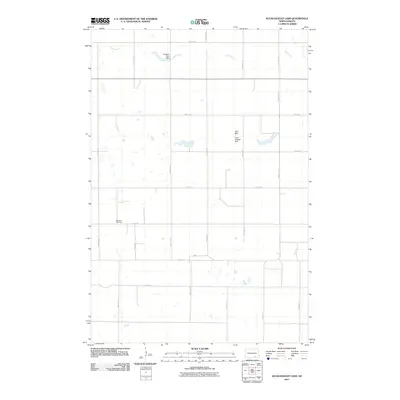
2011 Map of Kulm-Edgeley Dam
USGS Topo · Published 2011About this map
The Maple River meanders through this portion of North Dakota, where the landscape is defined by the critical infrastructure of the northern plains. This 2011 survey documents a series of water management sites including the Kulm-Edgeley Dam, Schlecht-Thom Dam, and Jolin Dam, reflecting the region's reliance on localized reservoirs. The township is organized by a precise grid of section-line roads, with the Beresena Cemetery serving as a primary point of genealogical interest for those researching early settlement families in this agricultural corridor. While the terrain appears largely open, the concentration of named dams along the river valley suggests a highly managed rural environment, punctuated by thoroughfares like County Rd 64.
Find a feature on this map
20 named features on this map. Tap any name to fly to it.
Don’t see what you’re looking for? This feature index may not catch every label — zoom into the map to look around manually.
Map Details
Editions of this 2011 Kulm-Edgeley Dam Map
This is the sole edition of this map. No revisions or reprints were ever made.
Other maps of this area

1894 · Monango
USGS Topo · 1:62,500

1896 · Edgeley
USGS Topo · 1:125,000

1925 · Edgeley
USGS Topo · 1:125,000

1953 · Jamestown
USGS Topo · 1:250,000

1956 · Jamestown
USGS Topo · 1:250,000

1971 · Merricourt
USGS Topo · 1:24,000

1971 · Merricourt NW
USGS Topo · 1:24,000
1982 · Monango NW
USGS Topo · 1:24,000

1982 · Schlecht-Weixel Dam
USGS Topo · 1:24,000

1982 · Deisem
USGS Topo · 1:24,000