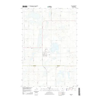
2014 Map of Kulm
USGS Topo · Published 2014About this map
Kulm serves as the central hub of this prairie landscape, situated near the boundary where LaMoure Co and Dickey Co meet. The settlement is defined by its organized grid and the nearby Kulm Municipal Airport, reflecting its role as a regional waypoint. Local heritage is deeply rooted in the several denominational and community burial sites surrounding the town, including the American Cem, Norwegian Cem, Gradenfeld Cem, and United Cem, which offer significant data points for genealogical research into the area's early families.
Find a feature on this map
25 named features on this map. Tap any name to fly to it.
Don’t see what you’re looking for? This feature index may not catch every label — zoom into the map to look around manually.
Map Details
Editions of this 2014 Kulm Map
This is the sole edition of this map. No revisions or reprints were ever made.
Other maps of this area

1896 · Edgeley
USGS Topo · 1:125,000

1925 · Edgeley
USGS Topo · 1:125,000

1953 · Jamestown
USGS Topo · 1:250,000

1956 · Jamestown
USGS Topo · 1:250,000

1971 · Merricourt
USGS Topo · 1:24,000

1971 · Merricourt NW
USGS Topo · 1:24,000

1982 · Coldwater Lake NE
USGS Topo · 1:24,000

1982 · Fredonia
USGS Topo · 1:24,000

1982 · Schlecht-Weixel Dam
USGS Topo · 1:24,000

1982 · Deisem
USGS Topo · 1:24,000