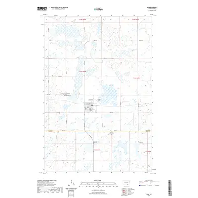
2020 Map of Kulm
USGS Topo · Published 2020About this map
The town of Kulm serves as the central hub of this prairie landscape, situated near the border of LaMoure and Dickey counties. The area is characterized by an extensive network of small wetlands and prairie potholes that dot the townships, creating a complex hydrology that drains toward the Maple River in the northeast. This 2020 survey reveals a community deeply connected to its heritage, evidenced by the high density of burial grounds surrounding the town. Genealogists will find a wealth of local history at sites like the Hillside Cem, Pomona Valley Lutheran Cem, and the Zion United Methodist Cem. The grid of section-line roads, including Co Rd 66 and 73rd St SE, facilitates transit between these dispersed rural landmarks and the aviation services at the Kulm Municipal Airport.
Find a feature on this map
42 named features on this map. Tap any name to fly to it.
Don’t see what you’re looking for? This feature index may not catch every label — zoom into the map to look around manually.
Map Details
Editions of this 2020 Kulm Map
This is the sole edition of this map. No revisions or reprints were ever made.
Other maps of this area

1896 · Edgeley
USGS Topo · 1:125,000

1925 · Edgeley
USGS Topo · 1:125,000

1953 · Jamestown
USGS Topo · 1:250,000

1956 · Jamestown
USGS Topo · 1:250,000

1971 · Merricourt
USGS Topo · 1:24,000

1971 · Merricourt NW
USGS Topo · 1:24,000

1982 · Coldwater Lake NE
USGS Topo · 1:24,000

1982 · Fredonia
USGS Topo · 1:24,000

1982 · Schlecht-Weixel Dam
USGS Topo · 1:24,000

1982 · Deisem
USGS Topo · 1:24,000