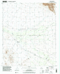
1996 Map of Kupk
USGS Topo · Published 2002About this map
The Tohono O'odham Indian Reservation landscape is defined here by a network of seasonal watercourses and desert settlements in the mid-1990s. The area features scattered community centers such as Kupk, Tonuk Vo, and Chuwut Murk, often centered around religious sites like St Francis Mission and St Theresa Mission. The terrain is characterized by a series of prominent peaks and washes, including the Kupk Hills and Chiweton Hill in the south, while the northern reaches are dominated by the slopes of South Mountain. An intricate system of drainage, marked by the Vamori Wash, San Luis Wash, and Gu Oidak Wash, illustrates the natural flow of water through this arid basin. Significant human footprints are also visible in the form of the Chicli Vo (Site) and various Grave locations, providing specific points of interest for genealogists and local historians studying the cultural geography of this region.
Find a feature on this map
22 named features on this map. Tap any name to fly to it.
Don’t see what you’re looking for? This feature index may not catch every label — zoom into the map to look around manually.
Map Details
Editions of this 1996 Kupk Map
This is the sole edition of this map. No revisions or reprints were ever made.
Other maps of this area

1953 · Ajo
USGS Topo · 1:250,000

1954 · Sonoyta
USGS Topo · 1:250,000

1957 · Ajo
USGS Topo · 1:250,000

1958 · Ajo
USGS Topo · 1:250,000

1962 · Ajo
USGS Topo · 1:250,000

1963 · Ajo
USGS Topo · 1:250,000

1963 · Kom Vo
USGS Topo · 1:62,500

1963 · Gu Oidak
USGS Topo · 1:62,500

1963 · Quijotoa Mts
USGS Topo · 1:62,500

1963 · Pisinimo
USGS Topo · 1:62,500
Featured Places
- Chukut Kuk District, AZ
- Sells, AZ
- Pisinemo District, AZ
- Chuwut Murk, Pisinemo District
- Kupk, Pisinemo District