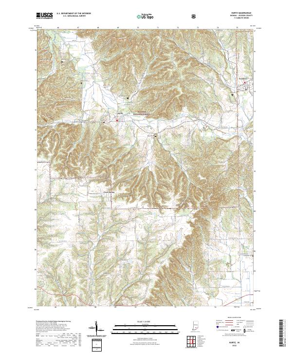
2022 Map of Kurtz
USGS Topo · Published 2022About this map
Hoosier National Forest dominates this Jackson County landscape, where the wooded uplands of Hickory Ridge are dissected by narrow valleys and hollows. The settlement pattern follows the drainage of South Fork Salt Creek and Guthrie Cr, with small communities like Kurtz and Clear Spring situated along the valley floors. These areas are connected by a grid of county roads that navigate the complex topography, providing access to numerous family burial sites including Hanner Cem, Cornett Cem, and Cummings Cem.
Find a feature on this map
56 named features on this map. Tap any name to fly to it.
Don’t see what you’re looking for? This feature index may not catch every label — zoom into the map to look around manually.
Map Details
Editions of this 2022 Kurtz Map
This is the sole edition of this map. No revisions or reprints were ever made.
Other maps of this area

1934 · Bedford
USGS Topo · 1:48,000

1937 · Bedford
USGS Topo · 1:62,500

1942 · Franklin
USGS Topo · 1:125,000

1947 · Elkinsville
USGS Topo · 1:24,000

1948 · Waymansville
USGS Topo · 1:24,000
1950 · Elkinsville
USGS Topo · 1:24,000

1953 · Indianapolis
USGS Topo · 1:250,000

1956 · Indianapolis
USGS Topo · 1:250,000

1956 · Story
USGS Topo · 1:24,000

1956 · Vincennes
USGS Topo · 1:250,000