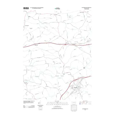
2013 Map of Kutztown
USGS Topo · Published 2013About this map
Kutztown and its surrounding rural townships are defined by a network of creeks and small crossroads settlements in the early 21st century. The landscape is dominated by the Sacony Cr and its tributaries, including Stony Run and Mill Cr, which historically powered the region's development. Local infrastructure is highlighted by historic crossings such as Heffners Bridge, Saucony Bridge, and Greenwich Bridge. The presence of the Kutztown Fairgrounds and Kutztown Fair Speedway indicates the area's role as a regional center for community gathering. In the northern reaches, the terrain rises toward Spitzenberg Hill near Greenawald and Albany, while major transportation corridors like Old 22 connect long-standing hamlets such as Krumsville and Grimville to the larger borough of Kutztown.
Find a feature on this map
186 named features on this map. Tap any name to fly to it.
Don’t see what you’re looking for? This feature index may not catch every label — zoom into the map to look around manually.
Map Details
Editions of this 2013 Kutztown Map
This is the sole edition of this map. No revisions or reprints were ever made.
Other maps of this area

1894 · Reading
USGS Topo · 1:62,500

1902 · Boyertown
USGS Topo · 1:62,500

1902 · Slatington
USGS Topo · 1:62,500

1909 · Hamburg
USGS Topo · 1:62,500

1911 · Hamburg
USGS Topo · 1:62,500

1913 · Reading
USGS Topo · 1:62,500

1915 · Reading
USGS Topo · 1:62,500

1937 · Allentown West
USGS Topo · 1:48,000

1942 · Allentown West
USGS Topo · 1:62,500

1943 · Manatawny
USGS Topo · 1:31,680