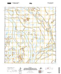
2020 Map of Kwiguk D-5 NE
USGS Topo · Published 2020About this map
Chulloonawick sits within a complex hydrologic network of the Yukon Delta, where the river splits into a labyrinth of named passes and sloughs. This 2020 map documents the intricate waterways of the Kusilvak Census Area, showing how the landscape is defined by the shifting paths of the Kwikpak Pass and Dunukchuvuk Slough. The distribution of seasonal settlements and camps in this region is dictated by these tidal and riverine channels, which serve as the primary transportation corridors.
Find a feature on this map
16 named features on this map. Tap any name to fly to it.
Don’t see what you’re looking for? This feature index may not catch every label — zoom into the map to look around manually.
Map Details
Editions of this 2020 Kwiguk D-5 NE Map
This is the sole edition of this map. No revisions or reprints were ever made.
Other maps of this area

1951 · St Michael
USGS Topo · 1:250,000

1952 · Kwiguk
USGS Topo · 1:250,000

1952 · Saint Michael A-5
USGS Topo · 1:63,360
1952 · Saint Michael A-4
USGS Topo · 1:63,360

1952 · Kwiguk D-5
USGS Topo · 1:63,360

1952 · Kwiguk D-4
USGS Topo · 1:63,360

1952 · St Michael
USGS Topo · 1:250,000

1964 · St. Michael
USGS Topo · 1:250,000
2020 · Saint Michael A-5 SW
USGS Topo · 1:25,000
2020 · Kwiguk D-4 NW
USGS Topo · 1:25,000