
1952 Map of Kwiguk D-5
USGS Topo · Published 1959About this map
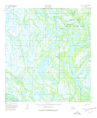
Kawanak Pass and Kwikpak Pass dominate this 1952 topographic study of the Yukon Delta, where a complex network of waterways defines the landscape. The map captures small settlements and seasonal sites along the banks, including Kawanak, Tuchiak, and Emangak. The intricate hydrography shows the delta's reliance on water transportation, with numerous channels such as Takwaklanuk Slough and Aproka Pass weaving through the marshy terrain.
Find a feature on this map
21 named features on this map. Tap any name to fly to it.
Don’t see what you’re looking for? This feature index may not catch every label — zoom into the map to look around manually.
Map Details
Editions of this 1952 Kwiguk D-5 Map
3 editions found
Other maps of this area

1951 · St Michael
USGS Topo · 1:250,000

1952 · Kwiguk
USGS Topo · 1:250,000

1952 · Saint Michael A-5
USGS Topo · 1:63,360
1952 · Saint Michael A-4
USGS Topo · 1:63,360
1952 · Saint Michael A-6
USGS Topo · 1:63,360

1952 · Kwiguk C-6
USGS Topo · 1:63,360

1952 · Kwiguk C-4
USGS Topo · 1:63,360

1952 · Kwiguk D-6
USGS Topo · 1:63,360

1952 · Kwiguk C-5
USGS Topo · 1:63,360

1952 · Kwiguk D-4
USGS Topo · 1:63,360