
1952 Map of Saint Michael A-5
USGS Topo · Published 1958About this map
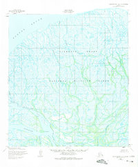
Norton Sound defines the northern edge of this coastal landscape, where the Yukon Delta's complex network of waterways meets the sea. This early 1950s survey illustrates a shifting hydrological environment dominated by major channels like Kwikpak Pass and Kawanak Pass. The interior is a maze of interconnected drainage systems, including Mahikpak Slough and Okshokwewhik Slough, which cut through the low-lying wetlands. Human presence is minimal and temporary, indicated only by scattered Cabins and surveying landmarks such as VABM Muktuk. The map captures the delta before more modern navigational or infrastructure changes, showing the natural state of features like Sea Gull Point and the vast tidal flats near Mud. This record is essential for understanding the historical geomorphology of the region and the early placement of seasonal shelters in the Alaskan wilderness.
Find a feature on this map
15 named features on this map. Tap any name to fly to it.
Don’t see what you’re looking for? This feature index may not catch every label — zoom into the map to look around manually.
Map Details
Editions of this 1952 Saint Michael A-5 Map
2 editions found
Other maps of this area

1951 · St Michael
USGS Topo · 1:250,000

1952 · Kwiguk
USGS Topo · 1:250,000
1952 · Saint Michael A-4
USGS Topo · 1:63,360
1952 · Saint Michael A-6
USGS Topo · 1:63,360

1952 · Kwiguk D-6
USGS Topo · 1:63,360

1952 · Kwiguk D-5
USGS Topo · 1:63,360

1952 · Kwiguk D-4
USGS Topo · 1:63,360

1952 · St Michael
USGS Topo · 1:250,000

1964 · St. Michael
USGS Topo · 1:250,000
2020 · Saint Michael A-5 SW
USGS Topo · 1:25,000