
1952 Map of Kwiguk D-6
USGS Topo · Published 1959About this map
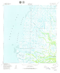
The labyrinthine delta of the lower Yukon River meets the Bering Sea in this mid-century topographic record, where the landscape is defined by an intricate network of tidal passes and sloughs. Small Cabins and the settlement of Kwiguk are the primary signs of human habitation along the massive Kwiguk Pass. The terrain is dominated by water and shifting silt, featuring vast areas of Mud along the coast and named landforms like Kawokhawik Island. Waterways such as Bugomowik Pass and Akanuklinuk Slough illustrate the complex drainage patterns of the tundra. Surveyors established local control points at VABM Bull and Bugom VABM to navigate this saturated environment, which relied heavily on seasonal water transport through channels like Kawokhawik Pass and the winding Elukomuk Slough.
Find a feature on this map
18 named features on this map. Tap any name to fly to it.
Don’t see what you’re looking for? This feature index may not catch every label — zoom into the map to look around manually.
Map Details
Editions of this 1952 Kwiguk D-6 Map
2 editions found
Other maps of this area

1951 · Black
USGS Topo · 1:250,000

1951 · St Michael
USGS Topo · 1:250,000

1952 · Kwiguk
USGS Topo · 1:250,000
1952 · Black C-1
USGS Topo · 1:63,360

1952 · Saint Michael A-5
USGS Topo · 1:63,360
1952 · Saint Michael A-6
USGS Topo · 1:63,360

1952 · Kwiguk C-6
USGS Topo · 1:63,360

1952 · Kwiguk C-5
USGS Topo · 1:63,360

1952 · Kwiguk D-5
USGS Topo · 1:63,360

1952 · St Michael
USGS Topo · 1:250,000