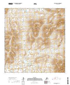
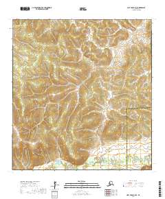
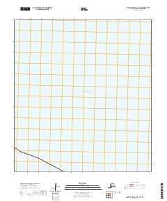
1951 Map of Black
USGS Topo · Published 1951About this map
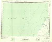
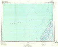
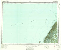
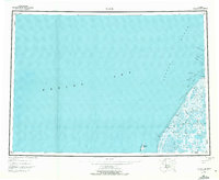
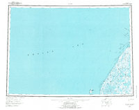
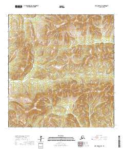
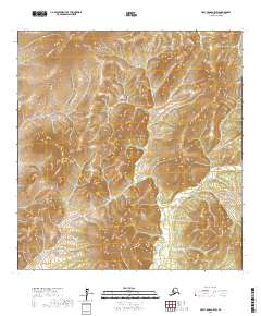
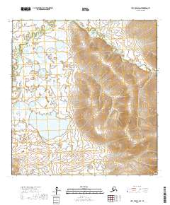
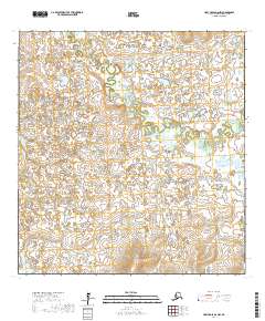
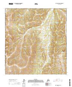
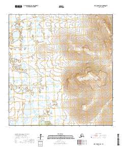
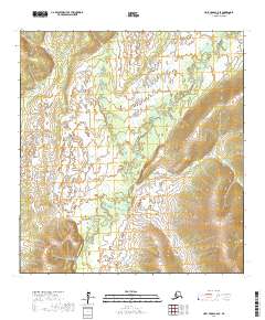
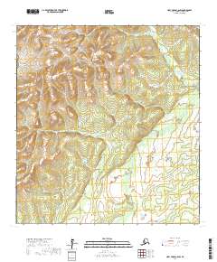
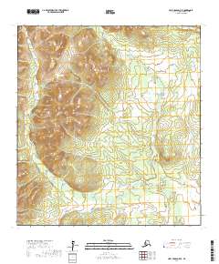
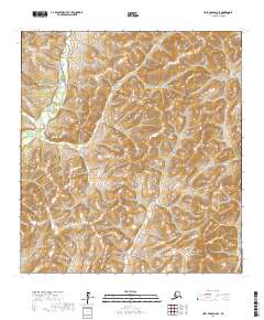
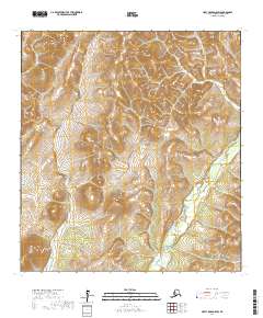
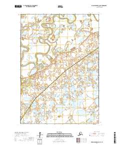
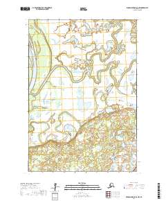
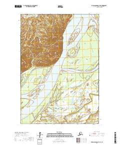
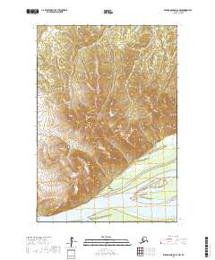
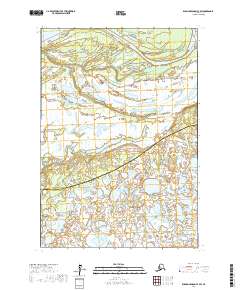
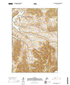
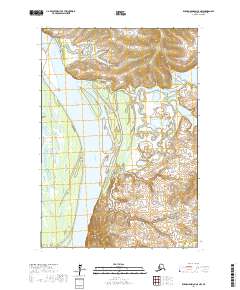
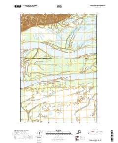
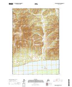
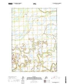
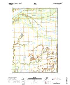
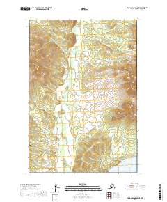
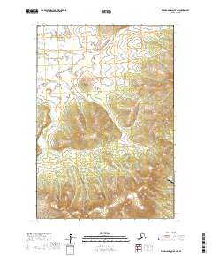
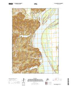
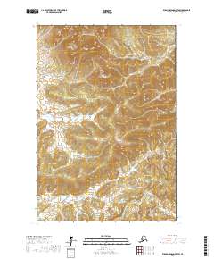
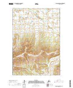
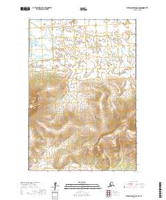
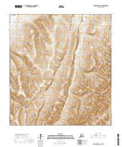
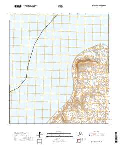
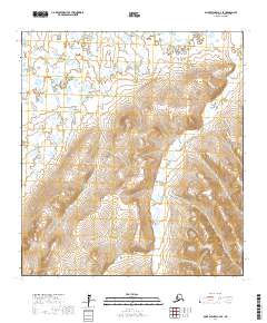
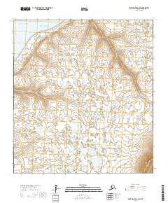
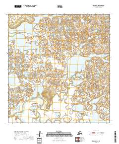
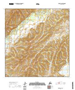
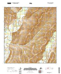
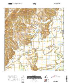
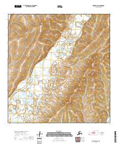
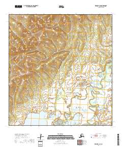
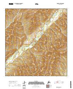
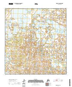
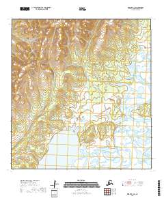
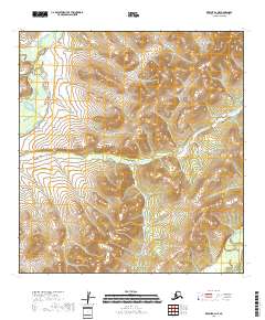
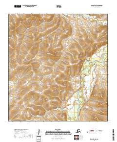
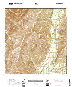
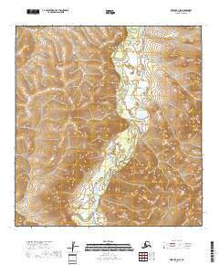
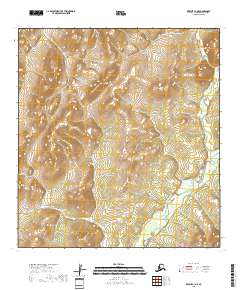
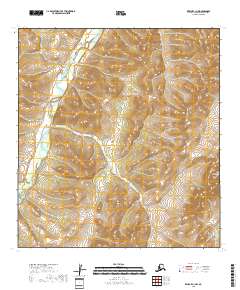
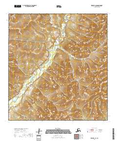
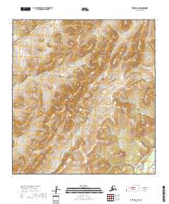
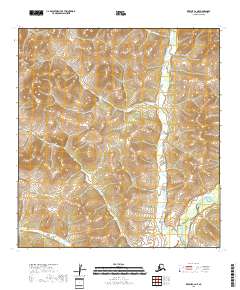
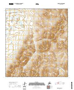
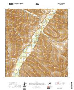
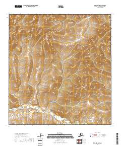
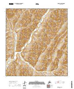
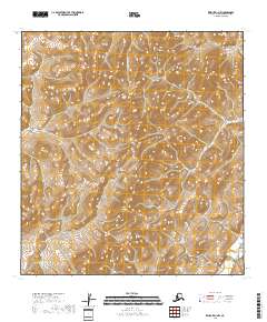
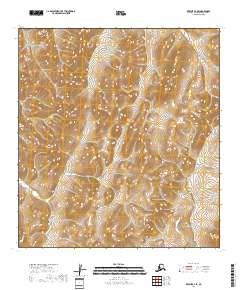
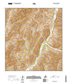
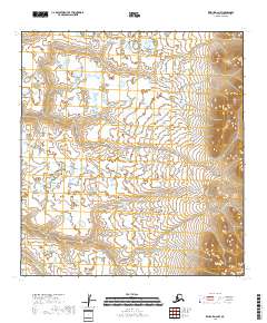
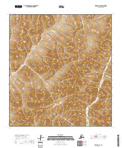
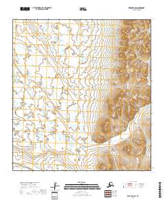
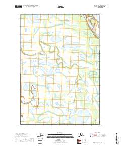
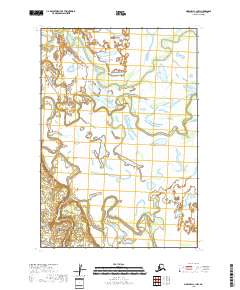
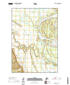
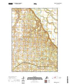
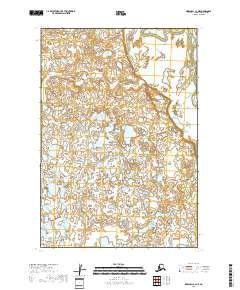
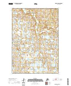
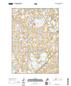
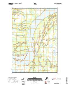
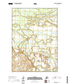
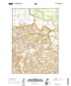
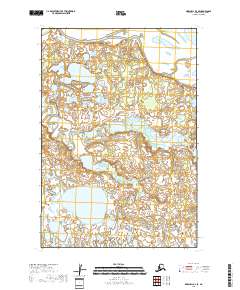
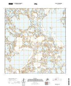
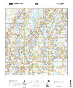
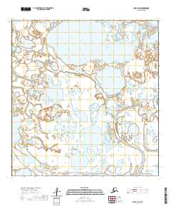
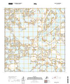
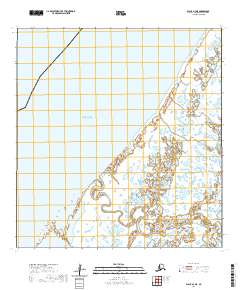
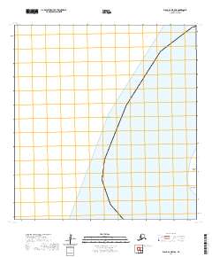
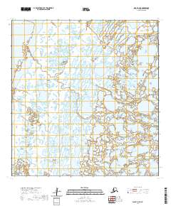
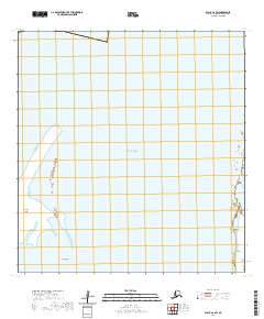
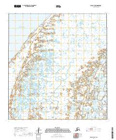
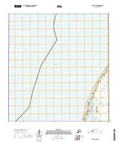
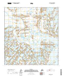
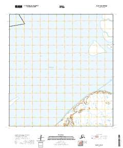
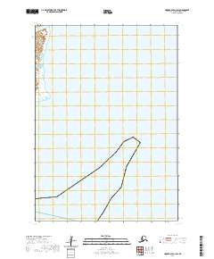
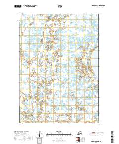
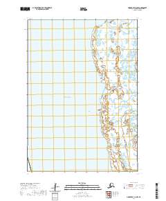
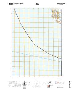
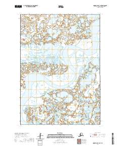
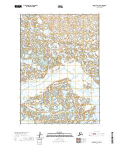
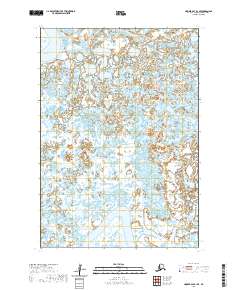
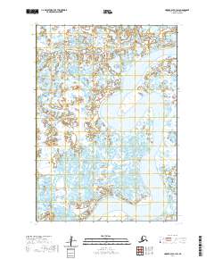
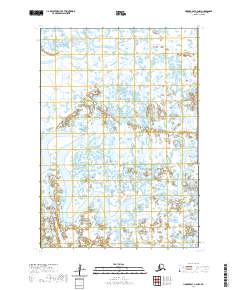
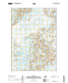
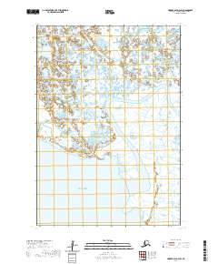
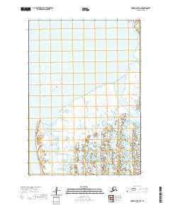
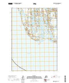
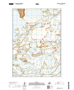
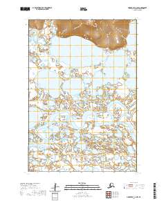
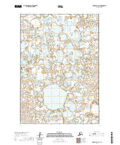
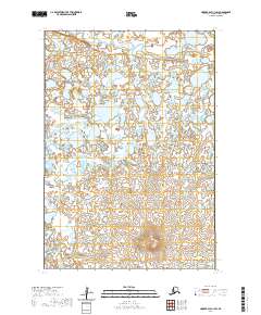
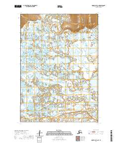
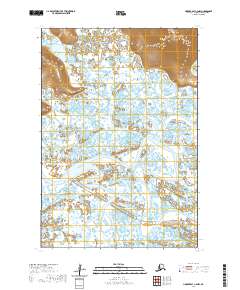
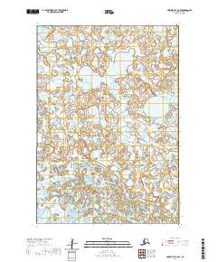
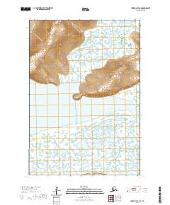
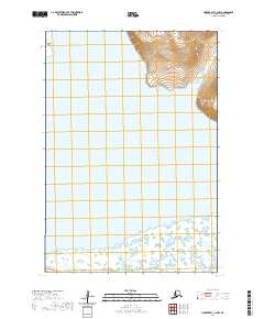
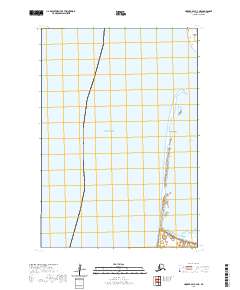
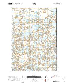
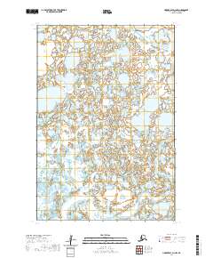
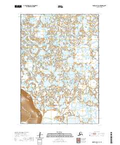
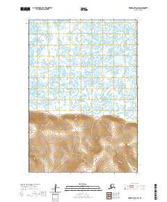
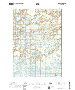
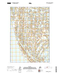
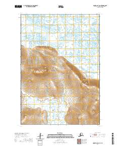
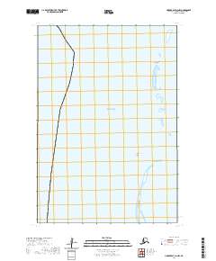
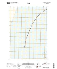
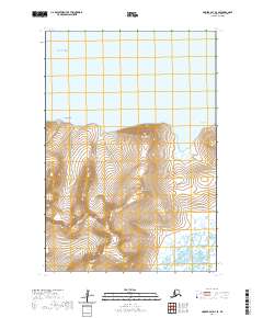
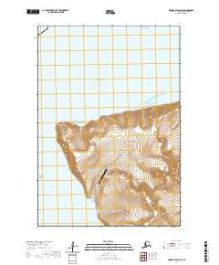
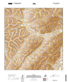
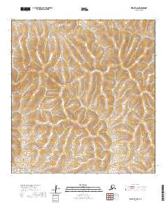
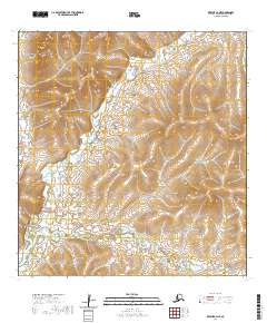
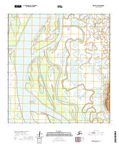
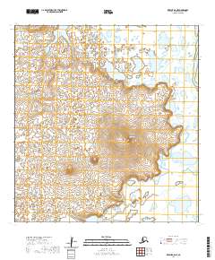
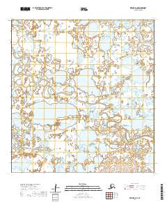
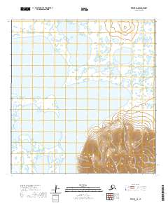
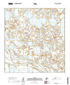
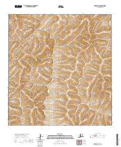
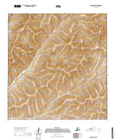
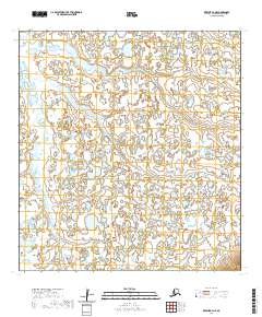
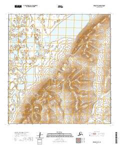
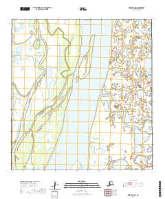
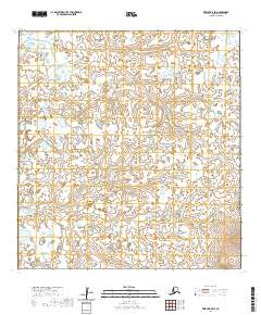
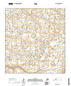
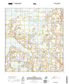
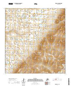
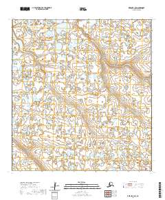
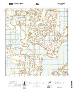
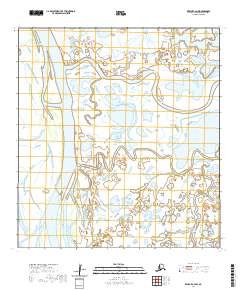
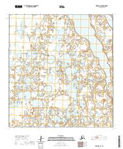
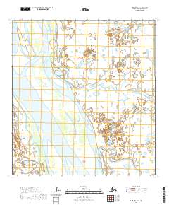
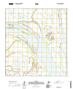
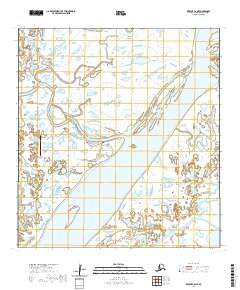
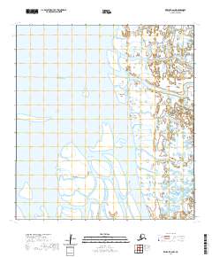
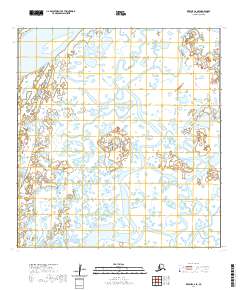
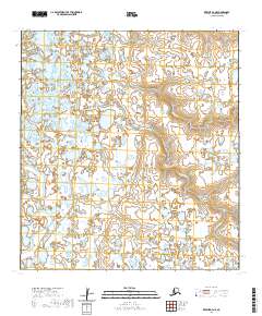
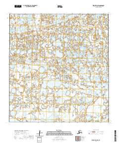
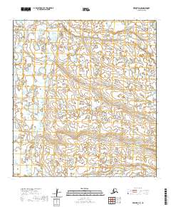
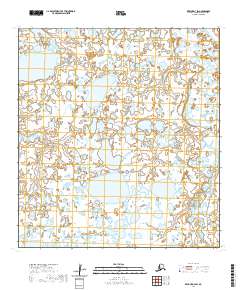
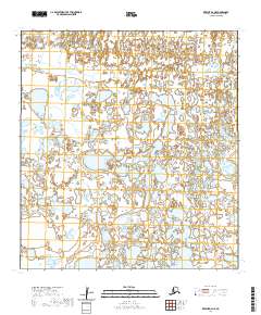
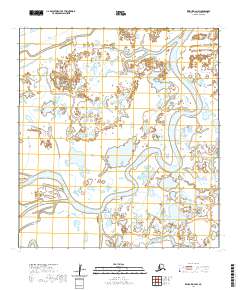
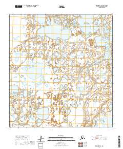
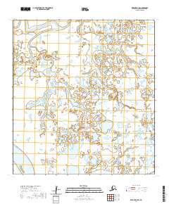
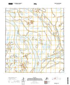
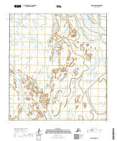
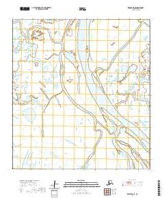
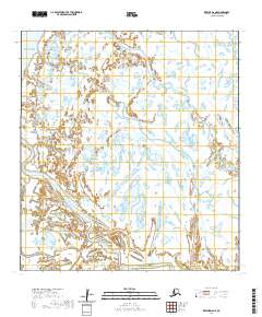
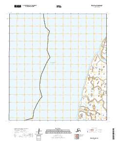
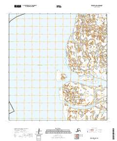
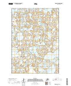
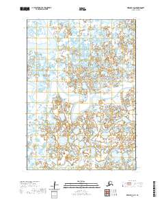
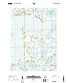
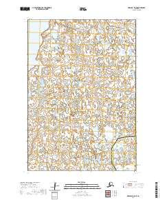
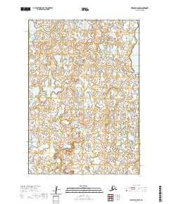
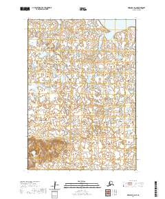
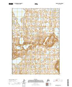
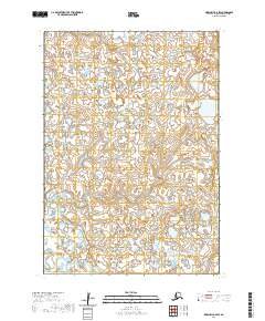
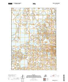
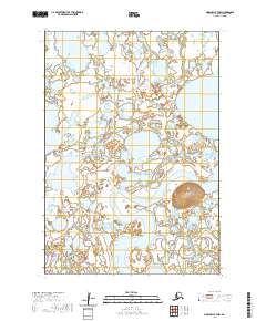
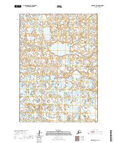
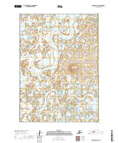
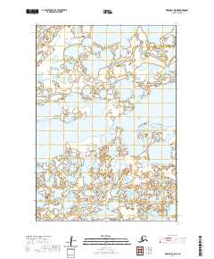
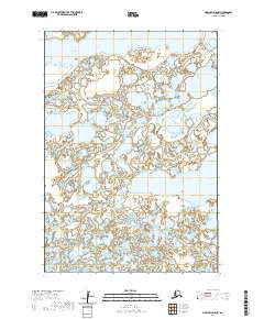
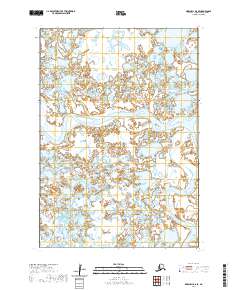
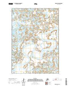
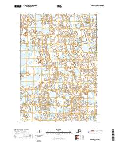
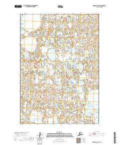
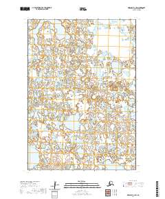
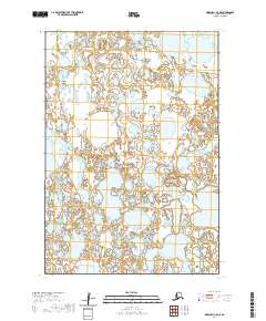
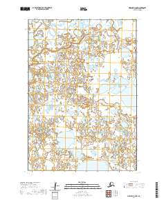
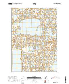
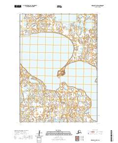
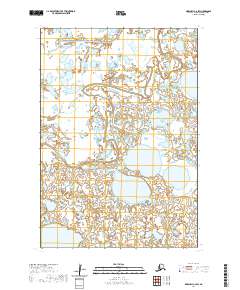
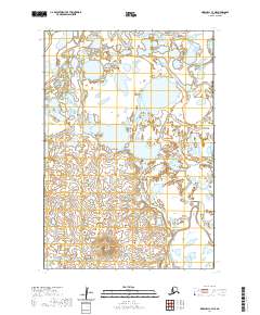
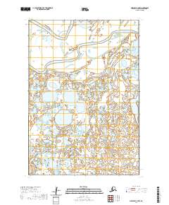
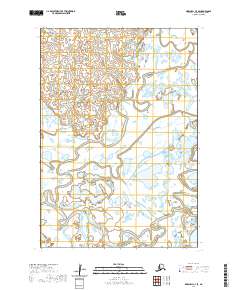
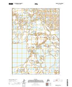
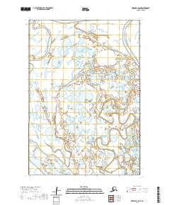
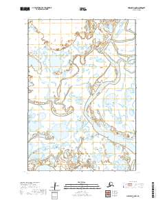
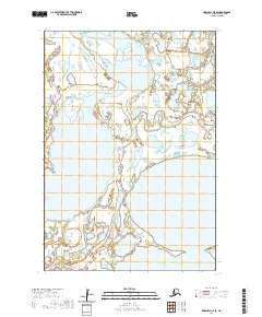
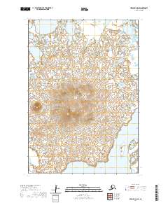
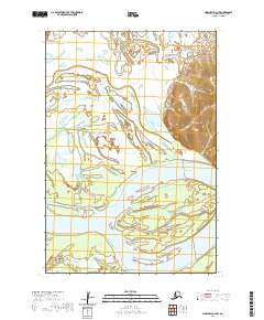
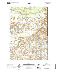
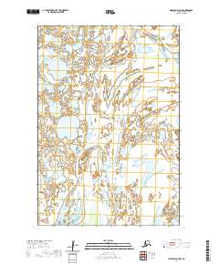
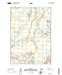
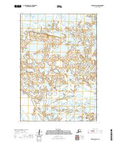
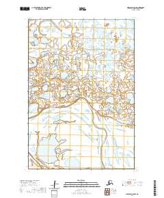
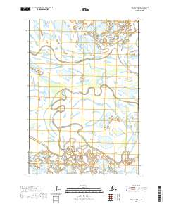
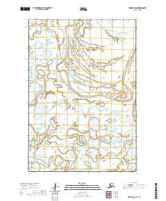
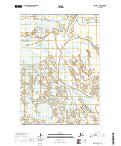
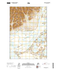
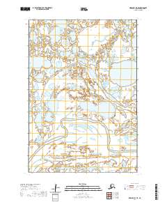
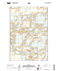
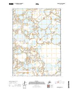
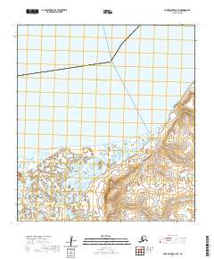
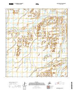
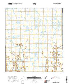
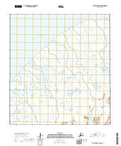
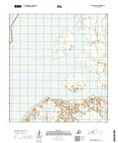
The coastal wetlands and complex river deltas where the Black River meets the Bering Sea define this mid-century reconnaissance survey. The geography is characterized by an intricate network of waterways, including the Nurukomarot Channel and Acharon Channel, which carve through the low-lying terrain of the Yukon-Kuskokwim Delta region. The sparse settlement pattern of the early 1950s is evident in small outposts like Bimiut and Black, while the notation for Kogomiut (Aband) provides a specific data point for researchers tracking the shifting occupancy of indigenous and seasonal sites.
Find a feature on this map
23 named features on this map. Tap any name to fly to it.
Don’t see what you’re looking for? This feature index may not catch every label — zoom into the map to look around manually.
Map Details
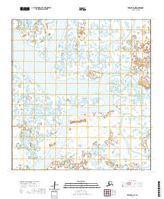
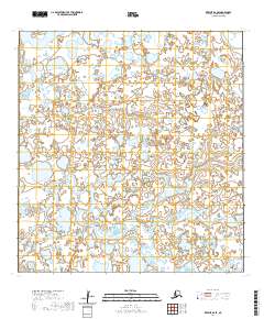
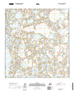
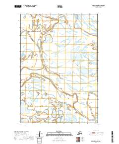
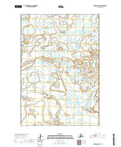
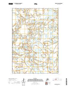
Editions of this 1951 Black Map
6 editions found
Historical Maps of Black Through Time
411 maps found

1951 Black
Kusilvak Borough, AK

1951 Holy Cross A-5
Kusilvak Borough, AK

1951 St Michael
Kusilvak Borough, AK

1952 Black A-1
Kusilvak Borough, AK

1952 Black A-2
Kusilvak Borough, AK

1952 Black B-1
Kusilvak Borough, AK

1952 Black C-1
Kusilvak Borough, AK

1952 Holy Cross A-5
Kusilvak Borough, AK

1952 Holy Cross A-6
Kusilvak Borough, AK

1952 Holy Cross B-5
Kusilvak Borough, AK

1952 Holy Cross B-6
Kusilvak Borough, AK

1952 Holy Cross C-5
Kusilvak Borough, AK

1952 Holy Cross C-6
Kusilvak Borough, AK

1952 Holy Cross D-5
Kusilvak Borough, AK

1952 Holy Cross D-6
Kusilvak Borough, AK

1952 Hooper Bay A-2
Kusilvak Borough, AK

1952 Hooper Bay B-3
Kusilvak Borough, AK

1952 Hooper Bay C-1
Kusilvak Borough, AK

1952 Hooper Bay C-3
Kusilvak Borough, AK

1952 Hooper Bay C-4
Kusilvak Borough, AK

1952 Hooper Bay D-1
Kusilvak Borough, AK

1952 Hooper Bay D-2
Kusilvak Borough, AK

1952 Kwiguk A-1
Kusilvak Borough, AK

1952 Kwiguk A-2
Kusilvak Borough, AK

1952 Kwiguk A-3
Kusilvak Borough, AK

1952 Kwiguk A-4
Kusilvak Borough, AK

1952 Kwiguk A-5
Kusilvak Borough, AK

1952 Kwiguk A-6
Kusilvak Borough, AK

1952 Kwiguk B-1
Kusilvak Borough, AK

1952 Kwiguk B-2
Kusilvak Borough, AK
1952 Kwiguk B-3
Kusilvak Borough, AK

1952 Kwiguk B-4
Kusilvak Borough, AK

1952 Kwiguk B-5
Kusilvak Borough, AK

1952 Kwiguk B-6
Kusilvak Borough, AK

1952 Kwiguk C-1
Kusilvak Borough, AK

1952 Kwiguk C-2
Kusilvak Borough, AK

1952 Kwiguk C-3
Kusilvak Borough, AK

1952 Kwiguk C-4
Kusilvak Borough, AK

1952 Kwiguk C-5
Kusilvak Borough, AK

1952 Kwiguk C-6
Kusilvak Borough, AK

1952 Kwiguk D-1
Kusilvak Borough, AK

1952 Kwiguk D-2
Kusilvak Borough, AK

1952 Kwiguk D-3
Kusilvak Borough, AK

1952 Kwiguk D-4
Kusilvak Borough, AK

1952 Kwiguk D-5
Kusilvak Borough, AK

1952 Kwiguk D-6
Kusilvak Borough, AK

1952 Kwiguk
Kusilvak Borough, AK

1952 Marshall C-1
Kusilvak Borough, AK

1952 Marshall C-5
Kusilvak Borough, AK

1952 Marshall C-6
Kusilvak Borough, AK

1952 Marshall C-7
Kusilvak Borough, AK

1952 Marshall C-8
Kusilvak Borough, AK

1952 Marshall D-1
Kusilvak Borough, AK

1952 Marshall D-2
Kusilvak Borough, AK

1952 Marshall D-3
Kusilvak Borough, AK

1952 Marshall D-4
Kusilvak Borough, AK

1952 Marshall D-5
Kusilvak Borough, AK

1952 Marshall D-6
Kusilvak Borough, AK

1952 Marshall D-7
Kusilvak Borough, AK

1952 Marshall D-8
Kusilvak Borough, AK

1952 Russian Mission C-7
Kusilvak Borough, AK

1952 Russian Mission C-8
Kusilvak Borough, AK

1952 Russian Mission D-5
Kusilvak Borough, AK

1952 Russian Mission D-6
Kusilvak Borough, AK

1952 Russian Mission D-7
Kusilvak Borough, AK

1952 Russian Mission D-8
Kusilvak Borough, AK

1952 Saint Michael A-1
Kusilvak Borough, AK

1952 Saint Michael A-2
Kusilvak Borough, AK

1952 Saint Michael A-3
Kusilvak Borough, AK

1952 Saint Michael A-4
Kusilvak Borough, AK

1952 Saint Michael A-5
Kusilvak Borough, AK

1952 Saint Michael A-6
Kusilvak Borough, AK

1952 St Michael
Kusilvak Borough, AK

1953 Hooper Bay B-1
Kusilvak Borough, AK

1953 Hooper Bay B-2
Kusilvak Borough, AK

1953 Hooper Bay C-2
Kusilvak Borough, AK

1953 Hooper Bay D-3
Kusilvak Borough, AK

1953 Marshall B-5
Kusilvak Borough, AK

1953 Marshall B-6
Kusilvak Borough, AK

1953 Marshall B-7
Kusilvak Borough, AK

1953 Marshall B-8
Kusilvak Borough, AK

1954 Hooper Bay A-1
Kusilvak Borough, AK

1954 Marshall A-7
Kusilvak Borough, AK

1954 Marshall A-8
Kusilvak Borough, AK

1954 Marshall C-2
Kusilvak Borough, AK

1954 Marshall C-3
Kusilvak Borough, AK

1954 Marshall C-4
Kusilvak Borough, AK

1957 Marshall B-7
Kusilvak Borough, AK

1964 St. Michael
Kusilvak Borough, AK
2017 Holy Cross A-5 NE
Kusilvak Borough, AK
2017 Holy Cross A-5 NW
Kusilvak Borough, AK
2017 Holy Cross A-5 SE
Kusilvak Borough, AK
2017 Holy Cross A-5 SW
Kusilvak Borough, AK
2017 Holy Cross A-6 NE
Kusilvak Borough, AK
2017 Holy Cross A-6 NW
Kusilvak Borough, AK
2017 Holy Cross A-6 SE
Kusilvak Borough, AK
2017 Holy Cross A-6 SW
Kusilvak Borough, AK
2017 Holy Cross B-5 NE
Kusilvak Borough, AK
2017 Holy Cross B-5 NW
Kusilvak Borough, AK
2017 Holy Cross B-5 SE
Kusilvak Borough, AK
2017 Holy Cross B-5 SW
Kusilvak Borough, AK
2017 Holy Cross B-6 NE
Kusilvak Borough, AK
2017 Holy Cross B-6 NW
Kusilvak Borough, AK
2017 Holy Cross B-6 SE
Kusilvak Borough, AK
2017 Holy Cross B-6 SW
Kusilvak Borough, AK
2017 Holy Cross C-5 NE
Kusilvak Borough, AK
2017 Holy Cross C-5 NW
Kusilvak Borough, AK
2017 Holy Cross C-5 SE
Kusilvak Borough, AK
2017 Holy Cross C-5 SW
Kusilvak Borough, AK
2017 Holy Cross C-6 NE
Kusilvak Borough, AK
2017 Holy Cross C-6 NW
Kusilvak Borough, AK
2017 Holy Cross C-6 SE
Kusilvak Borough, AK
2017 Holy Cross C-6 SW
Kusilvak Borough, AK
2017 Holy Cross D-5 NE
Kusilvak Borough, AK
2017 Holy Cross D-5 NW
Kusilvak Borough, AK
2017 Holy Cross D-5 SE
Kusilvak Borough, AK
2017 Holy Cross D-5 SW
Kusilvak Borough, AK
2017 Holy Cross D-6 NE
Kusilvak Borough, AK
2017 Holy Cross D-6 NW
Kusilvak Borough, AK
2017 Holy Cross D-6 SE
Kusilvak Borough, AK
2017 Holy Cross D-6 SW
Kusilvak Borough, AK
2017 Russian Mission C-6 NE
Kusilvak Borough, AK
2017 Russian Mission C-6 NW
Kusilvak Borough, AK
2017 Russian Mission C-7 NE
Kusilvak Borough, AK
2017 Russian Mission C-7 NW
Kusilvak Borough, AK
2017 Russian Mission C-7 SW
Kusilvak Borough, AK
2017 Russian Mission C-8 NE
Kusilvak Borough, AK
2017 Russian Mission C-8 NW
Kusilvak Borough, AK
2017 Russian Mission C-8 SE
Kusilvak Borough, AK
2017 Russian Mission C-8 SW
Kusilvak Borough, AK
2017 Russian Mission D-5 NE
Kusilvak Borough, AK
2017 Russian Mission D-5 NW
Kusilvak Borough, AK
2017 Russian Mission D-5 SE
Kusilvak Borough, AK
2017 Russian Mission D-5 SW
Kusilvak Borough, AK
2017 Russian Mission D-6 NE
Kusilvak Borough, AK
2017 Russian Mission D-6 NW
Kusilvak Borough, AK
2017 Russian Mission D-6 SE
Kusilvak Borough, AK
2017 Russian Mission D-6 SW
Kusilvak Borough, AK
2017 Russian Mission D-7 NE
Kusilvak Borough, AK
2017 Russian Mission D-7 NW
Kusilvak Borough, AK
2017 Russian Mission D-7 SE
Kusilvak Borough, AK
2017 Russian Mission D-7 SW
Kusilvak Borough, AK
2017 Russian Mission D-8 NE
Kusilvak Borough, AK
2017 Russian Mission D-8 NW
Kusilvak Borough, AK
2017 Russian Mission D-8 SE
Kusilvak Borough, AK

2017 Russian Mission D-8 SW
Kusilvak Borough, AK
2017 Saint Michael A-1 NW
Kusilvak Borough, AK
2017 Saint Michael A-1 SE
Kusilvak Borough, AK
2017 Saint Michael A-1 SW
Kusilvak Borough, AK

2017 Saint Michael A-2 NE
Kusilvak Borough, AK
2017 Saint Michael A-2 NW
Kusilvak Borough, AK
2017 Saint Michael A-2 SE
Kusilvak Borough, AK
2017 Saint Michael A-2 SW
Kusilvak Borough, AK
2018 Kwiguk A-1 NE
Kusilvak Borough, AK
2018 Kwiguk A-1 NW
Kusilvak Borough, AK
2018 Kwiguk A-1 SE
Kusilvak Borough, AK
2018 Kwiguk A-1 SW
Kusilvak Borough, AK
2018 Kwiguk A-2 NE
Kusilvak Borough, AK
2018 Kwiguk A-2 NW
Kusilvak Borough, AK
2018 Kwiguk A-2 SE
Kusilvak Borough, AK
2018 Kwiguk A-2 SW
Kusilvak Borough, AK
2018 Kwiguk B-1 NE
Kusilvak Borough, AK
2018 Kwiguk B-1 NW
Kusilvak Borough, AK
2018 Kwiguk B-1 SE
Kusilvak Borough, AK
2018 Kwiguk B-1 SW
Kusilvak Borough, AK
2018 Kwiguk B-2 NE
Kusilvak Borough, AK
2018 Kwiguk B-2 NW
Kusilvak Borough, AK
2018 Kwiguk B-2 SE
Kusilvak Borough, AK
2018 Kwiguk B-2 SW
Kusilvak Borough, AK
2018 Kwiguk C-1 NE
Kusilvak Borough, AK
2018 Kwiguk C-1 NW
Kusilvak Borough, AK
2018 Kwiguk C-1 SE
Kusilvak Borough, AK
2018 Kwiguk C-1 SW
Kusilvak Borough, AK
2018 Kwiguk C-2 NE
Kusilvak Borough, AK
2018 Kwiguk C-2 NW
Kusilvak Borough, AK
2018 Kwiguk C-2 SE
Kusilvak Borough, AK
2018 Kwiguk C-2 SW
Kusilvak Borough, AK
2018 Kwiguk D-1 NE
Kusilvak Borough, AK
2018 Kwiguk D-1 NW
Kusilvak Borough, AK
2018 Kwiguk D-1 SE
Kusilvak Borough, AK
2018 Kwiguk D-1 SW
Kusilvak Borough, AK

2018 Kwiguk D-2 NE
Kusilvak Borough, AK
2018 Kwiguk D-2 NW
Kusilvak Borough, AK
2018 Kwiguk D-2 SE
Kusilvak Borough, AK
2018 Kwiguk D-2 SW
Kusilvak Borough, AK
2018 Marshall C-1 NE
Kusilvak Borough, AK
2018 Marshall C-1 NW
Kusilvak Borough, AK
2018 Marshall C-1 SE
Kusilvak Borough, AK
2018 Marshall C-1 SW
Kusilvak Borough, AK
2018 Marshall C-2 NE
Kusilvak Borough, AK
2018 Marshall C-2 NW
Kusilvak Borough, AK
2018 Marshall C-2 SE
Kusilvak Borough, AK
2018 Marshall C-2 SW
Kusilvak Borough, AK
2018 Marshall C-3 NE
Kusilvak Borough, AK
2018 Marshall C-3 SE
Kusilvak Borough, AK

2018 Marshall D-1 NE
Kusilvak Borough, AK
2018 Marshall D-1 NW
Kusilvak Borough, AK

2018 Marshall D-1 SE
Kusilvak Borough, AK
2018 Marshall D-1 SW
Kusilvak Borough, AK
2018 Marshall D-2 NE
Kusilvak Borough, AK
2018 Marshall D-2 NW
Kusilvak Borough, AK
2018 Marshall D-2 SE
Kusilvak Borough, AK
2018 Marshall D-2 SW
Kusilvak Borough, AK

2018 Marshall D-3 NE
Kusilvak Borough, AK
2018 Marshall D-3 SE
Kusilvak Borough, AK
2020 Black A-1 NE
Kusilvak Borough, AK
2020 Black A-1 NW
Kusilvak Borough, AK
2020 Black A-1 SE
Kusilvak Borough, AK
2020 Black A-1 SW
Kusilvak Borough, AK
2020 Black A-2 NE
Kusilvak Borough, AK
2020 Black A-2 OE W SE
Kusilvak Borough, AK
2020 Black A-2 SE
Kusilvak Borough, AK
2020 Black A-2 SW
Kusilvak Borough, AK
2020 Black B-1 NE
Kusilvak Borough, AK
2020 Black B-1 NW
Kusilvak Borough, AK
2020 Black B-1 OE W SE
Kusilvak Borough, AK
2020 Black B-1 SE
Kusilvak Borough, AK

2020 Black B-1 SW
Kusilvak Borough, AK
2020 Black C-1 SE
Kusilvak Borough, AK
2020 Hooper Bay A-1 NE
Kusilvak Borough, AK
2020 Hooper Bay A-1 NW
Kusilvak Borough, AK
2020 Hooper Bay A-1 SE
Kusilvak Borough, AK
2020 Hooper Bay A-1 SW
Kusilvak Borough, AK
2020 Hooper Bay A-2 NE
Kusilvak Borough, AK
2020 Hooper Bay A-2 NW
Kusilvak Borough, AK
2020 Hooper Bay A-2 SE
Kusilvak Borough, AK
2020 Hooper Bay A-2 SW
Kusilvak Borough, AK
2020 Hooper Bay B-1 NE
Kusilvak Borough, AK
2020 Hooper Bay B-1 NW
Kusilvak Borough, AK
2020 Hooper Bay B-1 SE
Kusilvak Borough, AK
2020 Hooper Bay B-1 SW
Kusilvak Borough, AK

2020 Hooper Bay B-2 NE
Kusilvak Borough, AK
2020 Hooper Bay B-2 NW
Kusilvak Borough, AK
2020 Hooper Bay B-2 SE
Kusilvak Borough, AK
2020 Hooper Bay B-2 SW
Kusilvak Borough, AK
2020 Hooper Bay B-3 NE
Kusilvak Borough, AK

2020 Hooper Bay B-3 NW
Kusilvak Borough, AK
2020 Hooper Bay B-3 SE
Kusilvak Borough, AK
2020 Hooper Bay C-1 NE
Kusilvak Borough, AK
2020 Hooper Bay C-1 NW
Kusilvak Borough, AK
2020 Hooper Bay C-1 SE
Kusilvak Borough, AK
2020 Hooper Bay C-1 SW
Kusilvak Borough, AK
2020 Hooper Bay C-2 NE
Kusilvak Borough, AK
2020 Hooper Bay C-2 NW
Kusilvak Borough, AK
2020 Hooper Bay C-2 SE
Kusilvak Borough, AK

2020 Hooper Bay C-2 SW
Kusilvak Borough, AK
2020 Hooper Bay C-3 NE
Kusilvak Borough, AK
2020 Hooper Bay C-3 NW
Kusilvak Borough, AK

2020 Hooper Bay C-3 SE
Kusilvak Borough, AK

2020 Hooper Bay C-3 SW
Kusilvak Borough, AK
2020 Hooper Bay C-4 NE
Kusilvak Borough, AK

2020 Hooper Bay C-4 SE
Kusilvak Borough, AK
2020 Hooper Bay D-1 NE
Kusilvak Borough, AK
2020 Hooper Bay D-1 NW
Kusilvak Borough, AK
2020 Hooper Bay D-1 SE
Kusilvak Borough, AK
2020 Hooper Bay D-1 SW
Kusilvak Borough, AK
2020 Hooper Bay D-2 NE
Kusilvak Borough, AK
2020 Hooper Bay D-2 NW
Kusilvak Borough, AK
2020 Hooper Bay D-2 SE
Kusilvak Borough, AK

2020 Hooper Bay D-2 SW
Kusilvak Borough, AK
2020 Hooper Bay D-3 NE
Kusilvak Borough, AK
2020 Hooper Bay D-3 NW
Kusilvak Borough, AK
2020 Hooper Bay D-3 OE W SE
Kusilvak Borough, AK
2020 Hooper Bay D-3 SE
Kusilvak Borough, AK
2020 Hooper Bay D-3 SW
Kusilvak Borough, AK
2020 Kwiguk A-3 NE
Kusilvak Borough, AK
2020 Kwiguk A-3 NW
Kusilvak Borough, AK

2020 Kwiguk A-3 SE
Kusilvak Borough, AK

2020 Kwiguk A-3 SW
Kusilvak Borough, AK
2020 Kwiguk A-4 NE
Kusilvak Borough, AK
2020 Kwiguk A-4 NW
Kusilvak Borough, AK

2020 Kwiguk A-4 SE
Kusilvak Borough, AK

2020 Kwiguk A-4 SW
Kusilvak Borough, AK
2020 Kwiguk A-5 NE
Kusilvak Borough, AK
2020 Kwiguk A-5 NW
Kusilvak Borough, AK
2020 Kwiguk A-5 SE
Kusilvak Borough, AK
2020 Kwiguk A-5 SW
Kusilvak Borough, AK
2020 Kwiguk A-6 NE
Kusilvak Borough, AK

2020 Kwiguk A-6 NW
Kusilvak Borough, AK
2020 Kwiguk A-6 SE
Kusilvak Borough, AK
2020 Kwiguk A-6 SW
Kusilvak Borough, AK
2020 Kwiguk B-3 NE
Kusilvak Borough, AK

2020 Kwiguk B-3 NW
Kusilvak Borough, AK
2020 Kwiguk B-3 SE
Kusilvak Borough, AK
2020 Kwiguk B-3 SW
Kusilvak Borough, AK
2020 Kwiguk B-4 NE
Kusilvak Borough, AK

2020 Kwiguk B-4 NW
Kusilvak Borough, AK
2020 Kwiguk B-4 SE
Kusilvak Borough, AK
2020 Kwiguk B-4 SW
Kusilvak Borough, AK
2020 Kwiguk B-5 NE
Kusilvak Borough, AK
2020 Kwiguk B-5 NW
Kusilvak Borough, AK
2020 Kwiguk B-5 SE
Kusilvak Borough, AK
2020 Kwiguk B-5 SW
Kusilvak Borough, AK
2020 Kwiguk B-6 NE
Kusilvak Borough, AK

2020 Kwiguk B-6 NW
Kusilvak Borough, AK
2020 Kwiguk B-6 SE
Kusilvak Borough, AK
2020 Kwiguk B-6 SW
Kusilvak Borough, AK
2020 Kwiguk C-3 NE
Kusilvak Borough, AK
2020 Kwiguk C-3 NW
Kusilvak Borough, AK
2020 Kwiguk C-3 SE
Kusilvak Borough, AK
2020 Kwiguk C-3 SW
Kusilvak Borough, AK
2020 Kwiguk C-4 NE
Kusilvak Borough, AK
2020 Kwiguk C-4 NW
Kusilvak Borough, AK
2020 Kwiguk C-4 SE
Kusilvak Borough, AK
2020 Kwiguk C-4 SW
Kusilvak Borough, AK
2020 Kwiguk C-5 NE
Kusilvak Borough, AK
2020 Kwiguk C-5 NW
Kusilvak Borough, AK
2020 Kwiguk C-5 SE
Kusilvak Borough, AK
2020 Kwiguk C-5 SW
Kusilvak Borough, AK
2020 Kwiguk C-6 NE
Kusilvak Borough, AK
2020 Kwiguk C-6 NW
Kusilvak Borough, AK
2020 Kwiguk C-6 SE
Kusilvak Borough, AK

2020 Kwiguk C-6 SW
Kusilvak Borough, AK
2020 Kwiguk D-3 NE
Kusilvak Borough, AK
2020 Kwiguk D-3 NW
Kusilvak Borough, AK
2020 Kwiguk D-3 SE
Kusilvak Borough, AK
2020 Kwiguk D-3 SW
Kusilvak Borough, AK
2020 Kwiguk D-4 NE
Kusilvak Borough, AK
2020 Kwiguk D-4 NW
Kusilvak Borough, AK
2020 Kwiguk D-4 SE
Kusilvak Borough, AK
2020 Kwiguk D-4 SW
Kusilvak Borough, AK
2020 Kwiguk D-5 NE
Kusilvak Borough, AK
2020 Kwiguk D-5 NW
Kusilvak Borough, AK
2020 Kwiguk D-5 SE
Kusilvak Borough, AK

2020 Kwiguk D-5 SW
Kusilvak Borough, AK
2020 Kwiguk D-6 NE
Kusilvak Borough, AK
2020 Kwiguk D-6 NW
Kusilvak Borough, AK

2020 Kwiguk D-6 SE
Kusilvak Borough, AK
2020 Kwiguk D-6 SW
Kusilvak Borough, AK
2020 Marshall A-6 NW
Kusilvak Borough, AK
2020 Marshall A-7 NE
Kusilvak Borough, AK
2020 Marshall A-7 NW
Kusilvak Borough, AK
2020 Marshall A-7 SE
Kusilvak Borough, AK
2020 Marshall A-7 SW
Kusilvak Borough, AK
2020 Marshall A-8 NE
Kusilvak Borough, AK
2020 Marshall A-8 NW
Kusilvak Borough, AK
2020 Marshall A-8 SE
Kusilvak Borough, AK
2020 Marshall A-8 SW
Kusilvak Borough, AK
2020 Marshall B-5 NE
Kusilvak Borough, AK
2020 Marshall B-5 NW
Kusilvak Borough, AK
2020 Marshall B-6 NE
Kusilvak Borough, AK
2020 Marshall B-6 NW
Kusilvak Borough, AK
2020 Marshall B-6 SW
Kusilvak Borough, AK
2020 Marshall B-7 NE
Kusilvak Borough, AK
2020 Marshall B-7 NW
Kusilvak Borough, AK
2020 Marshall B-7 SE
Kusilvak Borough, AK
2020 Marshall B-7 SW
Kusilvak Borough, AK
2020 Marshall B-8 NE
Kusilvak Borough, AK
2020 Marshall B-8 NW
Kusilvak Borough, AK
2020 Marshall B-8 SE
Kusilvak Borough, AK
2020 Marshall B-8 SW
Kusilvak Borough, AK
2020 Marshall C-3 NW
Kusilvak Borough, AK
2020 Marshall C-3 SW
Kusilvak Borough, AK
2020 Marshall C-4 NE
Kusilvak Borough, AK
2020 Marshall C-4 NW
Kusilvak Borough, AK
2020 Marshall C-4 SE
Kusilvak Borough, AK
2020 Marshall C-4 SW
Kusilvak Borough, AK
2020 Marshall C-5 NE
Kusilvak Borough, AK
2020 Marshall C-5 NW
Kusilvak Borough, AK
2020 Marshall C-5 SE
Kusilvak Borough, AK
2020 Marshall C-5 SW
Kusilvak Borough, AK
2020 Marshall C-6 NE
Kusilvak Borough, AK
2020 Marshall C-6 NW
Kusilvak Borough, AK
2020 Marshall C-6 SE
Kusilvak Borough, AK
2020 Marshall C-6 SW
Kusilvak Borough, AK
2020 Marshall C-7 NE
Kusilvak Borough, AK
2020 Marshall C-7 NW
Kusilvak Borough, AK
2020 Marshall C-7 SE
Kusilvak Borough, AK
2020 Marshall C-7 SW
Kusilvak Borough, AK
2020 Marshall C-8 NE
Kusilvak Borough, AK
2020 Marshall C-8 NW
Kusilvak Borough, AK
2020 Marshall C-8 SE
Kusilvak Borough, AK
2020 Marshall C-8 SW
Kusilvak Borough, AK
2020 Marshall D-3 NW
Kusilvak Borough, AK
2020 Marshall D-3 SW
Kusilvak Borough, AK
2020 Marshall D-4 NE
Kusilvak Borough, AK
2020 Marshall D-4 NW
Kusilvak Borough, AK

2020 Marshall D-4 SE
Kusilvak Borough, AK
2020 Marshall D-4 SW
Kusilvak Borough, AK
2020 Marshall D-5 NE
Kusilvak Borough, AK
2020 Marshall D-5 NW
Kusilvak Borough, AK
2020 Marshall D-5 SE
Kusilvak Borough, AK
2020 Marshall D-5 SW
Kusilvak Borough, AK
2020 Marshall D-6 NE
Kusilvak Borough, AK
2020 Marshall D-6 NW
Kusilvak Borough, AK
2020 Marshall D-6 SE
Kusilvak Borough, AK

2020 Marshall D-6 SW
Kusilvak Borough, AK
2020 Marshall D-7 NE
Kusilvak Borough, AK
2020 Marshall D-7 NW
Kusilvak Borough, AK
2020 Marshall D-7 SE
Kusilvak Borough, AK
2020 Marshall D-7 SW
Kusilvak Borough, AK
2020 Marshall D-8 NE
Kusilvak Borough, AK
2020 Marshall D-8 NW
Kusilvak Borough, AK
2020 Marshall D-8 SE
Kusilvak Borough, AK
2020 Marshall D-8 SW
Kusilvak Borough, AK
2020 Saint Michael A-3 SE
Kusilvak Borough, AK

2020 Saint Michael A-3 SW
Kusilvak Borough, AK
2020 Saint Michael A-4 NE
Kusilvak Borough, AK
2020 Saint Michael A-4 NW
Kusilvak Borough, AK
2020 Saint Michael A-4 OE N SE
Kusilvak Borough, AK
2020 Saint Michael A-4 OE N SW
Kusilvak Borough, AK

2020 Saint Michael A-4 SE
Kusilvak Borough, AK
2020 Saint Michael A-4 SW
Kusilvak Borough, AK
2020 Saint Michael A-5 NE
Kusilvak Borough, AK
2020 Saint Michael A-5 NW
Kusilvak Borough, AK
2020 Saint Michael A-5 OE N SE
Kusilvak Borough, AK
2020 Saint Michael A-5 SE
Kusilvak Borough, AK

2020 Saint Michael A-5 SW
Kusilvak Borough, AK
2020 Saint Michael A-6 NE
Kusilvak Borough, AK
2020 Saint Michael A-6 SE
Kusilvak Borough, AK
2020 Saint Michael A-6 SW
Kusilvak Borough, AK